You are here: Home > Network List > US - United States National Seismic Network Stations List
> Station MIAR Mount Ida, Arkansas, USA > Earthquake Result Viewer
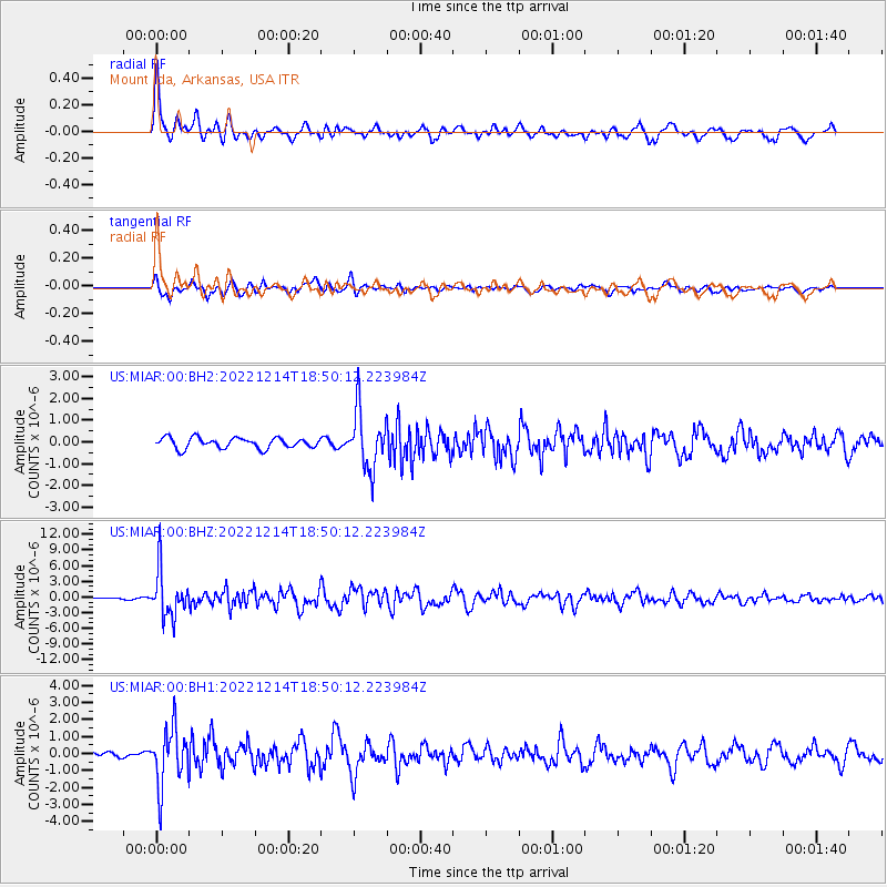
MIAR Mount Ida, Arkansas, USA - Earthquake Result Viewer
*The percent match for this event was below the threshold and hence no stack was calculated.
| Earthquake location: |
Rat Islands, Aleutian Islands |
| Earthquake latitude/longitude: |
51.6/178.6 |
| Earthquake time(UTC): |
2022/12/14 (348) 18:40:26 GMT |
| Earthquake Depth: |
73 km |
| Earthquake Magnitude: |
6.3 Mww |
| Earthquake Catalog/Contributor: |
NEIC PDE/us |
|
| Network: |
US United States National Seismic Network |
| Station: |
MIAR Mount Ida, Arkansas, USA |
| Lat/Lon: |
34.55 N/93.58 W |
| Elevation: |
207 m |
|
| Distance: |
62.5 deg |
| Az: |
68.361 deg |
| Baz: |
315.409 deg |
| Ray Param: |
$rayparam |
*The percent match for this event was below the threshold and hence was not used in the summary stack. |
|
| Radial Match: |
74.65991 % |
| Radial Bump: |
400 |
| Transverse Match: |
71.414345 % |
| Transverse Bump: |
400 |
| SOD ConfigId: |
29823551 |
| Insert Time: |
2022-12-28 19:23:13.562 +0000 |
| GWidth: |
2.5 |
| Max Bumps: |
400 |
| Tol: |
0.001 |
|
Signal To Noise
| Channel | StoN | STA | LTA |
| US:MIAR:00:BHZ:20221214T18:50:12.223984Z | 13.378252 | 4.476319E-6 | 3.3459673E-7 |
| US:MIAR:00:BH1:20221214T18:50:12.223984Z | 7.6173086 | 1.6801175E-6 | 2.2056577E-7 |
| US:MIAR:00:BH2:20221214T18:50:12.223984Z | 5.4745307 | 1.3291531E-6 | 2.427885E-7 |
| Arrivals |
| Ps | |
| PpPs | |
| PsPs/PpSs | |


