You are here: Home > Network List > TA - USArray Transportable Network (new EarthScope stations) Stations List
> Station 435B Jarrell, TX, USA > Earthquake Result Viewer
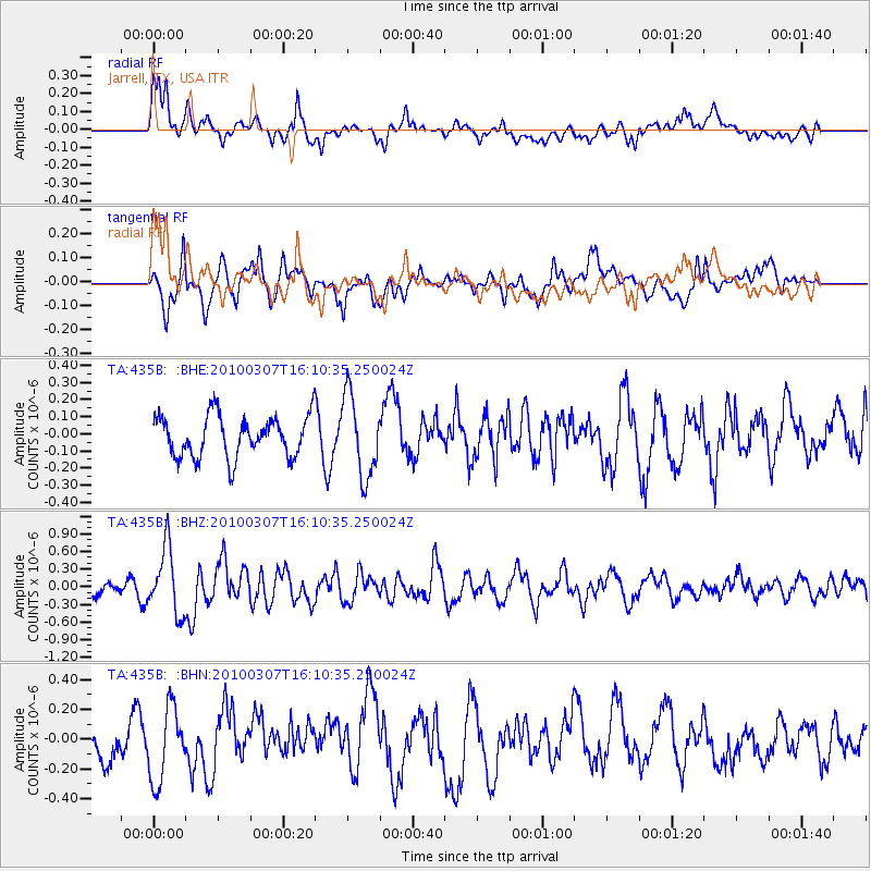
435B Jarrell, TX, USA - Earthquake Result Viewer
*The percent match for this event was below the threshold and hence no stack was calculated.
| Earthquake location: |
Near Coast Of Central Chile |
| Earthquake latitude/longitude: |
-38.0/-73.3 |
| Earthquake time(UTC): |
2010/03/07 (066) 15:59:44 GMT |
| Earthquake Depth: |
27 km |
| Earthquake Magnitude: |
5.5 MB, 5.6 MS, 5.8 MW, 5.8 MW |
| Earthquake Catalog/Contributor: |
WHDF/NEIC |
|
| Network: |
TA USArray Transportable Network (new EarthScope stations) |
| Station: |
435B Jarrell, TX, USA |
| Lat/Lon: |
30.78 N/97.58 W |
| Elevation: |
248 m |
|
| Distance: |
72.1 deg |
| Az: |
338.161 deg |
| Baz: |
160.03 deg |
| Ray Param: |
$rayparam |
*The percent match for this event was below the threshold and hence was not used in the summary stack. |
|
| Radial Match: |
69.90542 % |
| Radial Bump: |
400 |
| Transverse Match: |
62.57677 % |
| Transverse Bump: |
400 |
| SOD ConfigId: |
299721 |
| Insert Time: |
2010-04-26 18:47:27.187 +0000 |
| GWidth: |
2.5 |
| Max Bumps: |
400 |
| Tol: |
0.001 |
|
Signal To Noise
| Channel | StoN | STA | LTA |
| TA:435B: :BHZ:20100307T16:10:35.250024Z | 4.324614 | 5.5755913E-7 | 1.2892691E-7 |
| TA:435B: :BHN:20100307T16:10:35.250024Z | 2.7060053 | 2.4641508E-7 | 9.1062304E-8 |
| TA:435B: :BHE:20100307T16:10:35.250024Z | 1.9655704 | 2.3716484E-7 | 1.2065955E-7 |
| Arrivals |
| Ps | |
| PpPs | |
| PsPs/PpSs | |


