You are here: Home > Network List > IW - Intermountain West Stations List
> Station MOOW Moose Ponds, Wyoming, USA > Earthquake Result Viewer
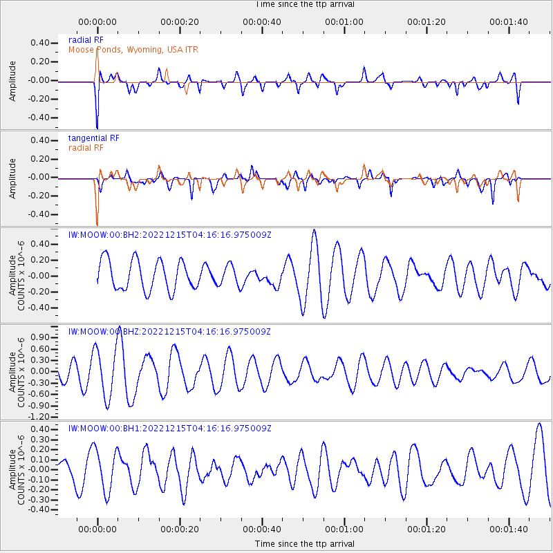
MOOW Moose Ponds, Wyoming, USA - Earthquake Result Viewer
*The percent match for this event was below the threshold and hence no stack was calculated.
| Earthquake location: |
Taiwan |
| Earthquake latitude/longitude: |
23.8/121.8 |
| Earthquake time(UTC): |
2022/12/15 (349) 04:03:15 GMT |
| Earthquake Depth: |
13 km |
| Earthquake Magnitude: |
5.9 mww |
| Earthquake Catalog/Contributor: |
NEIC PDE/us |
|
| Network: |
IW Intermountain West |
| Station: |
MOOW Moose Ponds, Wyoming, USA |
| Lat/Lon: |
43.75 N/110.74 W |
| Elevation: |
2128 m |
|
| Distance: |
97.3 deg |
| Az: |
35.448 deg |
| Baz: |
312.848 deg |
| Ray Param: |
$rayparam |
*The percent match for this event was below the threshold and hence was not used in the summary stack. |
|
| Radial Match: |
72.089554 % |
| Radial Bump: |
400 |
| Transverse Match: |
54.958256 % |
| Transverse Bump: |
360 |
| SOD ConfigId: |
29823551 |
| Insert Time: |
2022-12-29 04:17:06.173 +0000 |
| GWidth: |
2.5 |
| Max Bumps: |
400 |
| Tol: |
0.001 |
|
Signal To Noise
| Channel | StoN | STA | LTA |
| IW:MOOW:00:BHZ:20221215T04:16:16.975009Z | 3.4706378 | 6.5027575E-7 | 1.873649E-7 |
| IW:MOOW:00:BH1:20221215T04:16:16.975009Z | 1.4315344 | 2.0918849E-7 | 1.4612885E-7 |
| IW:MOOW:00:BH2:20221215T04:16:16.975009Z | 0.68782586 | 1.2760178E-7 | 1.8551466E-7 |
| Arrivals |
| Ps | |
| PpPs | |
| PsPs/PpSs | |


