You are here: Home > Network List > IW - Intermountain West Stations List
> Station MOOW Moose Ponds, Wyoming, USA > Earthquake Result Viewer
MOOW Moose Ponds, Wyoming, USA - Earthquake Result Viewer
*The percent match for this event was below the threshold and hence no stack was calculated.
| Earthquake location: |
Off Coast Of Central America |
| Earthquake latitude/longitude: |
12.9/-88.5 |
| Earthquake time(UTC): |
2022/12/15 (349) 14:32:23 GMT |
| Earthquake Depth: |
74 km |
| Earthquake Magnitude: |
5.7 Mww |
| Earthquake Catalog/Contributor: |
NEIC PDE/us |
|
| Network: |
IW Intermountain West |
| Station: |
MOOW Moose Ponds, Wyoming, USA |
| Lat/Lon: |
43.75 N/110.74 W |
| Elevation: |
2128 m |
|
| Distance: |
36.2 deg |
| Az: |
332.252 deg |
| Baz: |
141.22 deg |
| Ray Param: |
$rayparam |
*The percent match for this event was below the threshold and hence was not used in the summary stack. |
|
| Radial Match: |
61.48313 % |
| Radial Bump: |
400 |
| Transverse Match: |
70.81039 % |
| Transverse Bump: |
400 |
| SOD ConfigId: |
29823551 |
| Insert Time: |
2022-12-29 14:46:36.921 +0000 |
| GWidth: |
2.5 |
| Max Bumps: |
400 |
| Tol: |
0.001 |
|
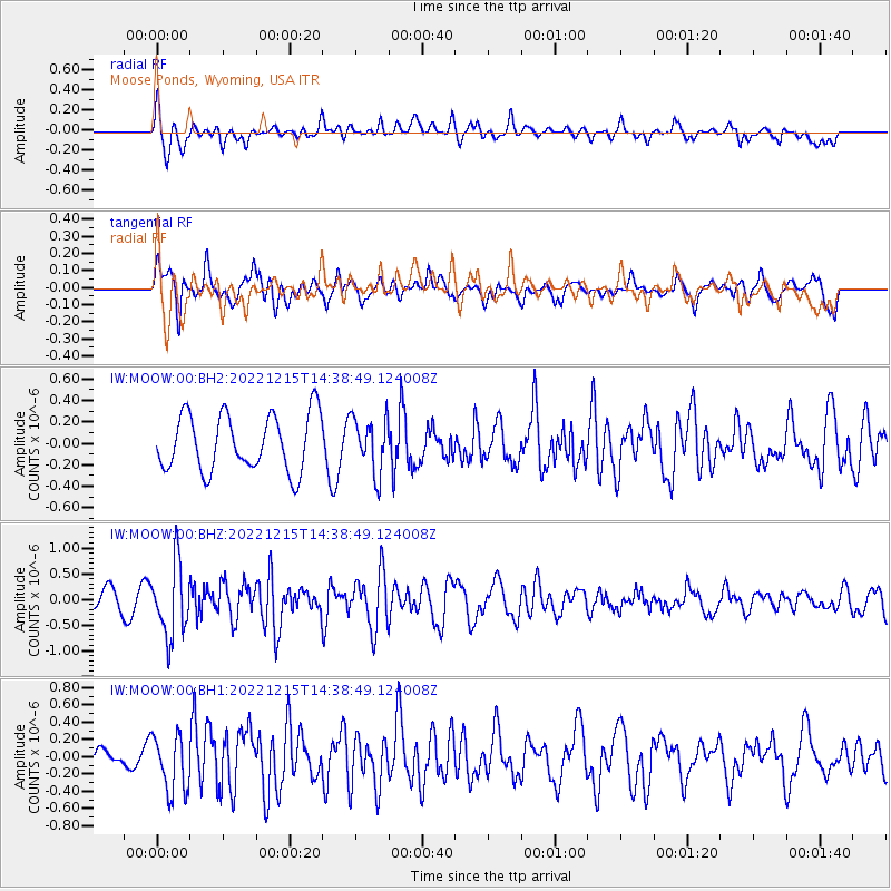
Signal To Noise
| Channel | StoN | STA | LTA |
| IW:MOOW:00:BHZ:20221215T14:38:49.124008Z | 2.9137235 | 7.0442115E-7 | 2.4175978E-7 |
| IW:MOOW:00:BH1:20221215T14:38:49.124008Z | 1.9074283 | 3.3280145E-7 | 1.7447653E-7 |
| IW:MOOW:00:BH2:20221215T14:38:49.124008Z | 0.9651477 | 2.550479E-7 | 2.642579E-7 |
| Arrivals |
| Ps | |
| PpPs | |
| PsPs/PpSs | |


