You are here: Home > Network List > TA - USArray Transportable Network (new EarthScope stations) Stations List
> Station BRSD Miller, SD, USA > Earthquake Result Viewer
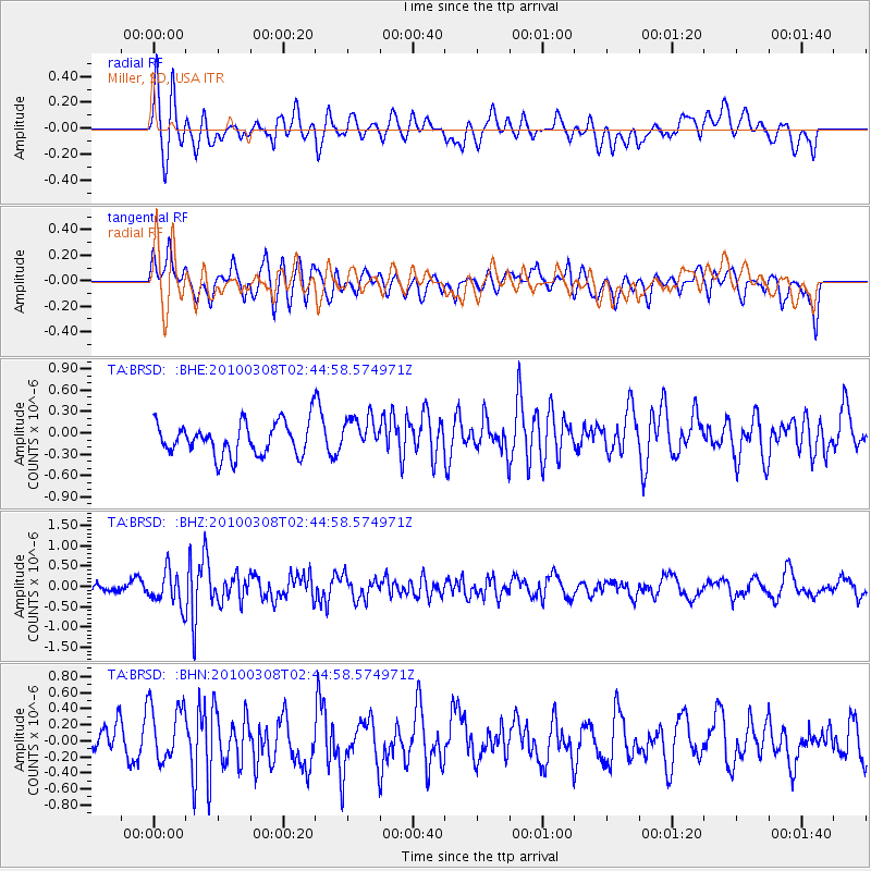
BRSD Miller, SD, USA - Earthquake Result Viewer
*The percent match for this event was below the threshold and hence no stack was calculated.
| Earthquake location: |
Turkey |
| Earthquake latitude/longitude: |
38.9/40.0 |
| Earthquake time(UTC): |
2010/03/08 (067) 02:32:34 GMT |
| Earthquake Depth: |
12 km |
| Earthquake Magnitude: |
5.9 MB, 6.0 MS, 6.1 MW, 6.1 MW |
| Earthquake Catalog/Contributor: |
WHDF/NEIC |
|
| Network: |
TA USArray Transportable Network (new EarthScope stations) |
| Station: |
BRSD Miller, SD, USA |
| Lat/Lon: |
44.44 N/98.96 W |
| Elevation: |
519 m |
|
| Distance: |
89.2 deg |
| Az: |
331.932 deg |
| Baz: |
30.85 deg |
| Ray Param: |
$rayparam |
*The percent match for this event was below the threshold and hence was not used in the summary stack. |
|
| Radial Match: |
52.772156 % |
| Radial Bump: |
400 |
| Transverse Match: |
67.93775 % |
| Transverse Bump: |
400 |
| SOD ConfigId: |
299721 |
| Insert Time: |
2010-04-26 19:01:43.383 +0000 |
| GWidth: |
2.5 |
| Max Bumps: |
400 |
| Tol: |
0.001 |
|
Signal To Noise
| Channel | StoN | STA | LTA |
| TA:BRSD: :BHZ:20100308T02:44:58.574971Z | 3.0962296 | 4.205727E-7 | 1.3583383E-7 |
| TA:BRSD: :BHN:20100308T02:44:58.574971Z | 1.6833558 | 3.6972878E-7 | 2.1963793E-7 |
| TA:BRSD: :BHE:20100308T02:44:58.574971Z | 1.0734009 | 2.4486872E-7 | 2.281242E-7 |
| Arrivals |
| Ps | |
| PpPs | |
| PsPs/PpSs | |


