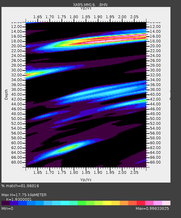
MM16 Lake Newton, Illinois - Earthquake Result Viewer

Earthquake location: Near Coast Of Central Chile
Earthquake latitude/longitude: -29.0/-71.5
Earthquake time(UTC): 1995/11/01 (305) 00:35:32 GMT
Earthquake Depth: 20 km
Earthquake Magnitude: 6.3 MB, 6.4 MS, 6.3 UNKNOWN, 6.7 MW
Earthquake Catalog/Contributor: WHDF/NEIC
Network: XA Missouri to Massachusetts Transect
Station: MM16 Lake Newton, Illinois
Lat/Lon: 38.92 N/88.30 W
Elevation: 165 m
Distance: 69.3 deg
Az: 346.054 deg
Baz: 164.291 deg
Ray Param: 0.05570052
Estimated Moho Depth: 17.75 km
Estimated Crust Vp/Vs: 1.93
Assumed Crust Vp: 6.444 km/s
Estimated Crust Vs: 3.339 km/s
Estimated Crust Poisson's Ratio: 0.32
Radial Match: 81.86816 %
Radial Bump: 384
Transverse Match: 60.166862 %
Transverse Bump: 400
SOD ConfigId: 6273
Insert Time: 2010-02-26 17:55:16.432 +0000
GWidth: 2.5
Max Bumps: 400
Tol: 0.001

Signal To Noise

ChannelStoNSTALTA
XA:MM16: :BHN:19951101T00:46:07.115002Z2.93271111.3993088E-64.771383E-7
XA:MM16: :BHE:19951101T00:46:07.115002Z2.72063471.2594975E-64.6294252E-7
XA:MM16: :BHZ:19951101T00:46:07.115002Z16.3324324.4410485E-62.7191592E-7
Arrivals
Ps2.7 SECOND
PpPs7.8 SECOND
PsPs/PpSs10 SECOND