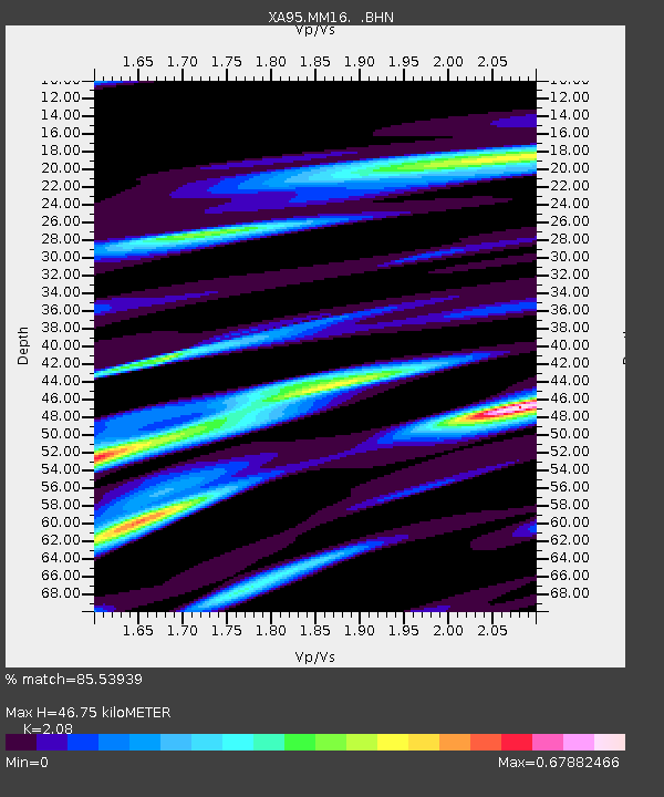
MM16 Lake Newton, Illinois - Earthquake Result Viewer

Earthquake location: Fox Islands, Aleutian Islands
Earthquake latitude/longitude: 52.2/-168.7
Earthquake time(UTC): 1996/03/30 (090) 13:05:17 GMT
Earthquake Depth: 33 km
Earthquake Magnitude: 5.9 MB, 6.2 MS, 6.3 UNKNOWN, 6.1 ML
Earthquake Catalog/Contributor: WHDF/NEIC
Network: XA Missouri to Massachusetts Transect
Station: MM16 Lake Newton, Illinois
Lat/Lon: 38.92 N/88.30 W
Elevation: 165 m
Distance: 55.0 deg
Az: 69.817 deg
Baz: 312.24 deg
Ray Param: 0.0649979
Estimated Moho Depth: 46.75 km
Estimated Crust Vp/Vs: 2.08
Assumed Crust Vp: 6.444 km/s
Estimated Crust Vs: 3.098 km/s
Estimated Crust Poisson's Ratio: 0.35
Radial Match: 85.53939 %
Radial Bump: 400
Transverse Match: 59.368477 %
Transverse Bump: 400
SOD ConfigId: 6273
Insert Time: 2010-02-26 17:55:22.067 +0000
GWidth: 2.5
Max Bumps: 400
Tol: 0.001

Signal To Noise

ChannelStoNSTALTA
XA:MM16: :BHN:19960330T13:14:15.131995Z1.98531827.3353505E-73.6947984E-7
XA:MM16: :BHE:19960330T13:14:15.131995Z1.88011344.1826385E-72.2246736E-7
XA:MM16: :BHZ:19960330T13:14:15.131995Z5.18488841.5319382E-62.9546214E-7
Arrivals
Ps8.2 SECOND
PpPs21 SECOND
PsPs/PpSs30 SECOND