You are here: Home > Network List > XA95 - Missouri to Massachusetts Transect Stations List
> Station MM16 Lake Newton, Illinois > Earthquake Result Viewer
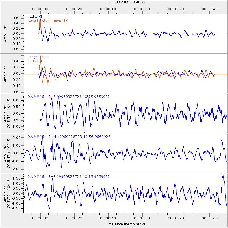
MM16 Lake Newton, Illinois - Earthquake Result Viewer
*The percent match for this event was below the threshold and hence no stack was calculated.
| Earthquake location: |
Ecuador |
| Earthquake latitude/longitude: |
-1.0/-78.7 |
| Earthquake time(UTC): |
1996/03/28 (088) 23:03:49 GMT |
| Earthquake Depth: |
33 km |
| Earthquake Magnitude: |
5.8 MB, 5.2 MS, 5.9 UNKNOWN, 5.1 MS |
| Earthquake Catalog/Contributor: |
WHDF/NEIC |
|
| Network: |
XA Missouri to Massachusetts Transect |
| Station: |
MM16 Lake Newton, Illinois |
| Lat/Lon: |
38.92 N/88.30 W |
| Elevation: |
165 m |
|
| Distance: |
40.7 deg |
| Az: |
348.538 deg |
| Baz: |
165.243 deg |
| Ray Param: |
$rayparam |
*The percent match for this event was below the threshold and hence was not used in the summary stack. |
|
| Radial Match: |
76.924995 % |
| Radial Bump: |
400 |
| Transverse Match: |
83.22661 % |
| Transverse Bump: |
400 |
| SOD ConfigId: |
4480 |
| Insert Time: |
2010-02-26 17:55:34.800 +0000 |
| GWidth: |
2.5 |
| Max Bumps: |
400 |
| Tol: |
0.001 |
|
Signal To Noise
| Channel | StoN | STA | LTA |
| XA:MM16: :BHN:19960328T23:10:56.966992Z | 1.528562 | 1.2110884E-6 | 7.9230574E-7 |
| XA:MM16: :BHE:19960328T23:10:56.966992Z | 1.1214247 | 5.2140757E-7 | 4.6495109E-7 |
| XA:MM16: :BHZ:19960328T23:10:56.966992Z | 0.874687 | 5.578481E-7 | 6.3776884E-7 |
| Arrivals |
| Ps | |
| PpPs | |
| PsPs/PpSs | |


