You are here: Home > Network List > US - United States National Seismic Network Stations List
> Station EGMT Eagleton, Montana, USA > Earthquake Result Viewer
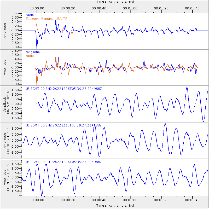
EGMT Eagleton, Montana, USA - Earthquake Result Viewer
*The percent match for this event was below the threshold and hence no stack was calculated.
| Earthquake location: |
Fiji Islands Region |
| Earthquake latitude/longitude: |
-19.2/-177.6 |
| Earthquake time(UTC): |
2022/12/26 (360) 05:27:53 GMT |
| Earthquake Depth: |
515 km |
| Earthquake Magnitude: |
5.5 Mww |
| Earthquake Catalog/Contributor: |
NEIC PDE/us |
|
| Network: |
US United States National Seismic Network |
| Station: |
EGMT Eagleton, Montana, USA |
| Lat/Lon: |
48.02 N/109.75 W |
| Elevation: |
1055 m |
|
| Distance: |
90.2 deg |
| Az: |
38.44 deg |
| Baz: |
241.054 deg |
| Ray Param: |
$rayparam |
*The percent match for this event was below the threshold and hence was not used in the summary stack. |
|
| Radial Match: |
63.99551 % |
| Radial Bump: |
400 |
| Transverse Match: |
57.96315 % |
| Transverse Bump: |
390 |
| SOD ConfigId: |
29823551 |
| Insert Time: |
2023-01-09 05:48:33.054 +0000 |
| GWidth: |
2.5 |
| Max Bumps: |
400 |
| Tol: |
0.001 |
|
Signal To Noise
| Channel | StoN | STA | LTA |
| US:EGMT:00:BHZ:20221226T05:39:27.224988Z | 0.6754991 | 2.8397503E-7 | 4.203929E-7 |
| US:EGMT:00:BH1:20221226T05:39:27.224988Z | 3.0839415 | 1.195737E-6 | 3.877301E-7 |
| US:EGMT:00:BH2:20221226T05:39:27.224988Z | 0.51665455 | 2.3844743E-7 | 4.6152198E-7 |
| Arrivals |
| Ps | |
| PpPs | |
| PsPs/PpSs | |


