You are here: Home > Network List > XA95 - Missouri to Massachusetts Transect Stations List
> Station MM16 Lake Newton, Illinois > Earthquake Result Viewer
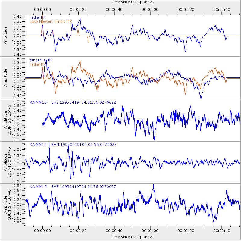
MM16 Lake Newton, Illinois - Earthquake Result Viewer
*The percent match for this event was below the threshold and hence no stack was calculated.
| Earthquake location: |
Kuril Islands |
| Earthquake latitude/longitude: |
44.0/148.2 |
| Earthquake time(UTC): |
1995/04/19 (109) 03:50:05 GMT |
| Earthquake Depth: |
33 km |
| Earthquake Magnitude: |
5.9 MB, 5.5 MS, 5.8 UNKNOWN, 5.7 MW |
| Earthquake Catalog/Contributor: |
WHDF/NEIC |
|
| Network: |
XA Missouri to Massachusetts Transect |
| Station: |
MM16 Lake Newton, Illinois |
| Lat/Lon: |
38.92 N/88.30 W |
| Elevation: |
165 m |
|
| Distance: |
82.9 deg |
| Az: |
40.958 deg |
| Baz: |
322.687 deg |
| Ray Param: |
$rayparam |
*The percent match for this event was below the threshold and hence was not used in the summary stack. |
|
| Radial Match: |
49.22692 % |
| Radial Bump: |
400 |
| Transverse Match: |
51.649536 % |
| Transverse Bump: |
400 |
| SOD ConfigId: |
4480 |
| Insert Time: |
2010-02-26 17:55:38.338 +0000 |
| GWidth: |
2.5 |
| Max Bumps: |
400 |
| Tol: |
0.001 |
|
Signal To Noise
| Channel | StoN | STA | LTA |
| XA:MM16: :BHN:19950419T04:01:56.027002Z | 2.5018282 | 4.716866E-7 | 1.8853676E-7 |
| XA:MM16: :BHE:19950419T04:01:56.027002Z | 1.0056156 | 2.6206123E-7 | 2.6059783E-7 |
| XA:MM16: :BHZ:19950419T04:01:56.027002Z | 1.0626485 | 1.6497249E-7 | 1.5524652E-7 |
| Arrivals |
| Ps | |
| PpPs | |
| PsPs/PpSs | |


