You are here: Home > Network List > XA95 - Missouri to Massachusetts Transect Stations List
> Station MM16 Lake Newton, Illinois > Earthquake Result Viewer
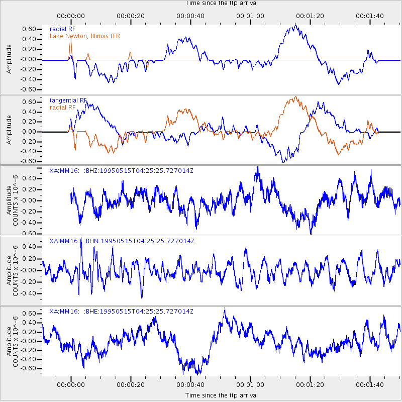
MM16 Lake Newton, Illinois - Earthquake Result Viewer
*The percent match for this event was below the threshold and hence no stack was calculated.
| Earthquake location: |
Greece |
| Earthquake latitude/longitude: |
40.0/21.6 |
| Earthquake time(UTC): |
1995/05/15 (135) 04:13:55 GMT |
| Earthquake Depth: |
10 km |
| Earthquake Magnitude: |
5.5 MD, 5.1 MB |
| Earthquake Catalog/Contributor: |
WHDF/NEIC |
|
| Network: |
XA Missouri to Massachusetts Transect |
| Station: |
MM16 Lake Newton, Illinois |
| Lat/Lon: |
38.92 N/88.30 W |
| Elevation: |
165 m |
|
| Distance: |
78.6 deg |
| Az: |
311.581 deg |
| Baz: |
47.401 deg |
| Ray Param: |
$rayparam |
*The percent match for this event was below the threshold and hence was not used in the summary stack. |
|
| Radial Match: |
46.453243 % |
| Radial Bump: |
400 |
| Transverse Match: |
39.156803 % |
| Transverse Bump: |
400 |
| SOD ConfigId: |
4480 |
| Insert Time: |
2010-02-26 17:55:39.379 +0000 |
| GWidth: |
2.5 |
| Max Bumps: |
400 |
| Tol: |
0.001 |
|
Signal To Noise
| Channel | StoN | STA | LTA |
| XA:MM16: :BHN:19950515T04:25:25.727014Z | 1.4326411 | 1.9443502E-7 | 1.3571787E-7 |
| XA:MM16: :BHE:19950515T04:25:25.727014Z | 3.0589902 | 3.7777153E-7 | 1.234955E-7 |
| XA:MM16: :BHZ:19950515T04:25:25.727014Z | 0.8274983 | 1.2462046E-7 | 1.5059904E-7 |
| Arrivals |
| Ps | |
| PpPs | |
| PsPs/PpSs | |


