You are here: Home > Network List > IU - Global Seismograph Network (GSN - IRIS/USGS) Stations List
> Station CTAO Charters Towers, Australia > Earthquake Result Viewer
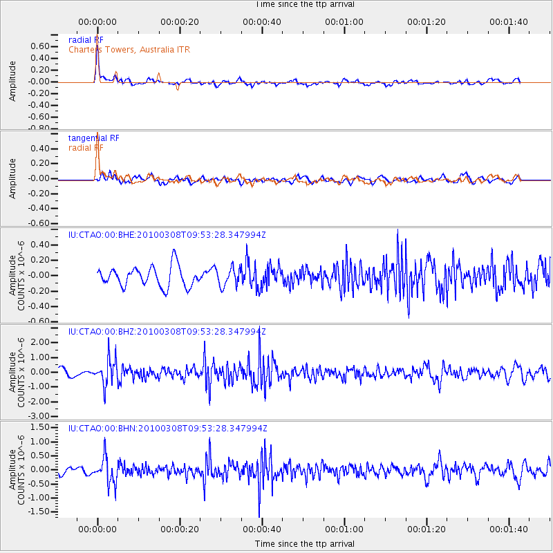
CTAO Charters Towers, Australia - Earthquake Result Viewer
*The percent match for this event was below the threshold and hence no stack was calculated.
| Earthquake location: |
Mariana Islands |
| Earthquake latitude/longitude: |
19.3/144.7 |
| Earthquake time(UTC): |
2010/03/08 (067) 09:47:11 GMT |
| Earthquake Depth: |
457 km |
| Earthquake Magnitude: |
6.0 MB, 6.1 MW, 6.1 MW |
| Earthquake Catalog/Contributor: |
WHDF/NEIC |
|
| Network: |
IU Global Seismograph Network (GSN - IRIS/USGS) |
| Station: |
CTAO Charters Towers, Australia |
| Lat/Lon: |
20.09 S/146.25 E |
| Elevation: |
357 m |
|
| Distance: |
39.2 deg |
| Az: |
177.701 deg |
| Baz: |
357.691 deg |
| Ray Param: |
$rayparam |
*The percent match for this event was below the threshold and hence was not used in the summary stack. |
|
| Radial Match: |
75.94922 % |
| Radial Bump: |
400 |
| Transverse Match: |
66.43132 % |
| Transverse Bump: |
400 |
| SOD ConfigId: |
299721 |
| Insert Time: |
2010-04-26 19:34:13.417 +0000 |
| GWidth: |
2.5 |
| Max Bumps: |
400 |
| Tol: |
0.001 |
|
Signal To Noise
| Channel | StoN | STA | LTA |
| IU:CTAO:00:BHZ:20100308T09:53:28.347994Z | 4.6609364 | 8.5518866E-7 | 1.8348E-7 |
| IU:CTAO:00:BHN:20100308T09:53:28.347994Z | 4.986841 | 4.6086012E-7 | 9.241524E-8 |
| IU:CTAO:00:BHE:20100308T09:53:28.347994Z | 0.89816874 | 1.1568559E-7 | 1.2880163E-7 |
| Arrivals |
| Ps | |
| PpPs | |
| PsPs/PpSs | |


