You are here: Home > Network List > XA95 - Missouri to Massachusetts Transect Stations List
> Station MM16 Lake Newton, Illinois > Earthquake Result Viewer
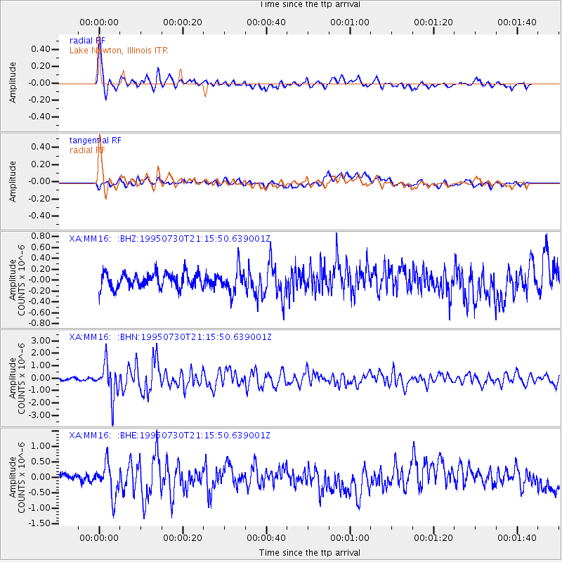
MM16 Lake Newton, Illinois - Earthquake Result Viewer
*The percent match for this event was below the threshold and hence no stack was calculated.
| Earthquake location: |
Near Coast Of Northern Chile |
| Earthquake latitude/longitude: |
-23.3/-70.6 |
| Earthquake time(UTC): |
1995/07/30 (211) 21:05:50 GMT |
| Earthquake Depth: |
33 km |
| Earthquake Magnitude: |
5.6 MB, 5.6 MS, 5.4 UNKNOWN, 6.1 MW |
| Earthquake Catalog/Contributor: |
WHDF/NEIC |
|
| Network: |
XA Missouri to Massachusetts Transect |
| Station: |
MM16 Lake Newton, Illinois |
| Lat/Lon: |
38.92 N/88.30 W |
| Elevation: |
165 m |
|
| Distance: |
64.1 deg |
| Az: |
344.701 deg |
| Baz: |
161.883 deg |
| Ray Param: |
$rayparam |
*The percent match for this event was below the threshold and hence was not used in the summary stack. |
|
| Radial Match: |
71.93778 % |
| Radial Bump: |
400 |
| Transverse Match: |
38.83721 % |
| Transverse Bump: |
400 |
| SOD ConfigId: |
4480 |
| Insert Time: |
2010-02-26 17:55:42.931 +0000 |
| GWidth: |
2.5 |
| Max Bumps: |
400 |
| Tol: |
0.001 |
|
Signal To Noise
| Channel | StoN | STA | LTA |
| XA:MM16: :BHN:19950730T21:15:50.639001Z | 13.31191 | 1.3359529E-6 | 1.00357724E-7 |
| XA:MM16: :BHE:19950730T21:15:50.639001Z | 3.4917424 | 5.480468E-7 | 1.569551E-7 |
| XA:MM16: :BHZ:19950730T21:15:50.639001Z | 1.6272256 | 2.2563893E-7 | 1.386648E-7 |
| Arrivals |
| Ps | |
| PpPs | |
| PsPs/PpSs | |


