You are here: Home > Network List > US - United States National Seismic Network Stations List
> Station WMOK Wichita Mountains, Oklahoma, USA > Earthquake Result Viewer
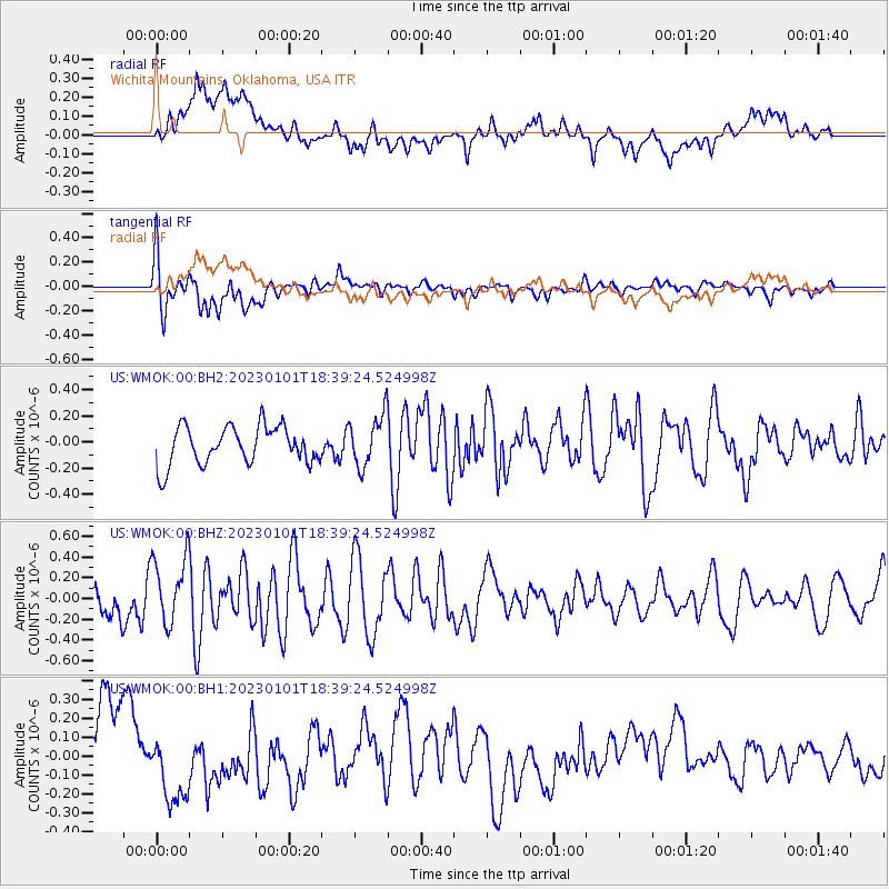
WMOK Wichita Mountains, Oklahoma, USA - Earthquake Result Viewer
*The percent match for this event was below the threshold and hence no stack was calculated.
| Earthquake location: |
Southern East Pacific Rise |
| Earthquake latitude/longitude: |
-56.2/-123.4 |
| Earthquake time(UTC): |
2023/01/01 (001) 18:26:42 GMT |
| Earthquake Depth: |
10 km |
| Earthquake Magnitude: |
5.8 Mww |
| Earthquake Catalog/Contributor: |
NEIC PDE/us |
|
| Network: |
US United States National Seismic Network |
| Station: |
WMOK Wichita Mountains, Oklahoma, USA |
| Lat/Lon: |
34.74 N/98.78 W |
| Elevation: |
486 m |
|
| Distance: |
93.0 deg |
| Az: |
20.12 deg |
| Baz: |
193.498 deg |
| Ray Param: |
$rayparam |
*The percent match for this event was below the threshold and hence was not used in the summary stack. |
|
| Radial Match: |
57.419292 % |
| Radial Bump: |
400 |
| Transverse Match: |
66.78658 % |
| Transverse Bump: |
400 |
| SOD ConfigId: |
29823551 |
| Insert Time: |
2023-01-15 18:49:33.033 +0000 |
| GWidth: |
2.5 |
| Max Bumps: |
400 |
| Tol: |
0.001 |
|
Signal To Noise
| Channel | StoN | STA | LTA |
| US:WMOK:00:BHZ:20230101T18:39:24.524998Z | 2.5310085 | 3.2753783E-7 | 1.2941E-7 |
| US:WMOK:00:BH1:20230101T18:39:24.524998Z | 1.0703399 | 1.8519997E-7 | 1.7302912E-7 |
| US:WMOK:00:BH2:20230101T18:39:24.524998Z | 1.3574553 | 1.9758905E-7 | 1.4555842E-7 |
| Arrivals |
| Ps | |
| PpPs | |
| PsPs/PpSs | |


