You are here: Home > Network List > TA - USArray Transportable Network (new EarthScope stations) Stations List
> Station U26A Atchley Ranch, Grenville, NM, USA > Earthquake Result Viewer
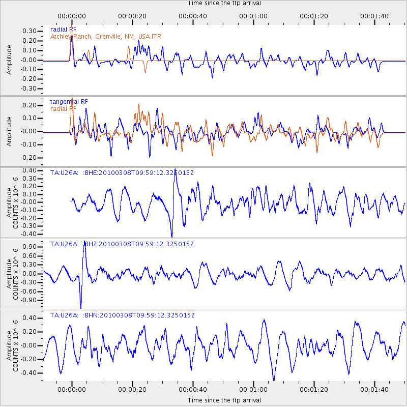
U26A Atchley Ranch, Grenville, NM, USA - Earthquake Result Viewer
*The percent match for this event was below the threshold and hence no stack was calculated.
| Earthquake location: |
Mariana Islands |
| Earthquake latitude/longitude: |
19.3/144.7 |
| Earthquake time(UTC): |
2010/03/08 (067) 09:47:11 GMT |
| Earthquake Depth: |
457 km |
| Earthquake Magnitude: |
6.0 MB, 6.1 MW, 6.1 MW |
| Earthquake Catalog/Contributor: |
WHDF/NEIC |
|
| Network: |
TA USArray Transportable Network (new EarthScope stations) |
| Station: |
U26A Atchley Ranch, Grenville, NM, USA |
| Lat/Lon: |
36.39 N/103.74 W |
| Elevation: |
1861 m |
|
| Distance: |
94.9 deg |
| Az: |
48.87 deg |
| Baz: |
298.169 deg |
| Ray Param: |
$rayparam |
*The percent match for this event was below the threshold and hence was not used in the summary stack. |
|
| Radial Match: |
62.705837 % |
| Radial Bump: |
400 |
| Transverse Match: |
63.132725 % |
| Transverse Bump: |
400 |
| SOD ConfigId: |
299721 |
| Insert Time: |
2010-04-26 19:41:49.624 +0000 |
| GWidth: |
2.5 |
| Max Bumps: |
400 |
| Tol: |
0.001 |
|
Signal To Noise
| Channel | StoN | STA | LTA |
| TA:U26A: :BHZ:20100308T09:59:12.325015Z | 3.5385187 | 5.228125E-7 | 1.4774896E-7 |
| TA:U26A: :BHN:20100308T09:59:12.325015Z | 1.8874979 | 1.7424742E-7 | 9.231662E-8 |
| TA:U26A: :BHE:20100308T09:59:12.325015Z | 2.0368068 | 2.2173478E-7 | 1.0886393E-7 |
| Arrivals |
| Ps | |
| PpPs | |
| PsPs/PpSs | |


