You are here: Home > Network List > IW - Intermountain West Stations List
> Station MOOW Moose Ponds, Wyoming, USA > Earthquake Result Viewer
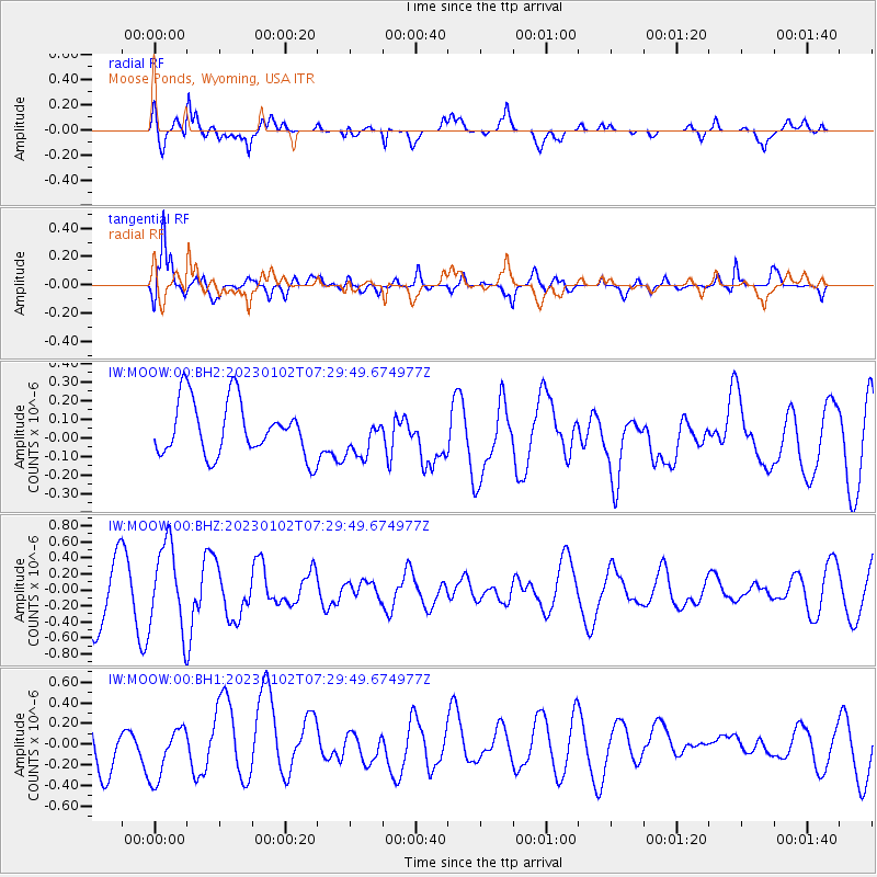
MOOW Moose Ponds, Wyoming, USA - Earthquake Result Viewer
*The percent match for this event was below the threshold and hence no stack was calculated.
| Earthquake location: |
Azores Islands Region |
| Earthquake latitude/longitude: |
40.5/-29.4 |
| Earthquake time(UTC): |
2023/01/02 (002) 07:20:27 GMT |
| Earthquake Depth: |
10 km |
| Earthquake Magnitude: |
5.3 Mww |
| Earthquake Catalog/Contributor: |
NEIC PDE/us |
|
| Network: |
IW Intermountain West |
| Station: |
MOOW Moose Ponds, Wyoming, USA |
| Lat/Lon: |
43.75 N/110.74 W |
| Elevation: |
2128 m |
|
| Distance: |
58.1 deg |
| Az: |
302.452 deg |
| Baz: |
62.681 deg |
| Ray Param: |
$rayparam |
*The percent match for this event was below the threshold and hence was not used in the summary stack. |
|
| Radial Match: |
67.430435 % |
| Radial Bump: |
400 |
| Transverse Match: |
61.18939 % |
| Transverse Bump: |
400 |
| SOD ConfigId: |
29823551 |
| Insert Time: |
2023-01-16 07:32:43.528 +0000 |
| GWidth: |
2.5 |
| Max Bumps: |
400 |
| Tol: |
0.001 |
|
Signal To Noise
| Channel | StoN | STA | LTA |
| IW:MOOW:00:BHZ:20230102T07:29:49.674977Z | 1.6150433 | 5.2533363E-7 | 3.2527524E-7 |
| IW:MOOW:00:BH1:20230102T07:29:49.674977Z | 1.347271 | 2.7331785E-7 | 2.0286778E-7 |
| IW:MOOW:00:BH2:20230102T07:29:49.674977Z | 0.7395378 | 1.0842448E-7 | 1.4661114E-7 |
| Arrivals |
| Ps | |
| PpPs | |
| PsPs/PpSs | |


