You are here: Home > Network List > US - United States National Seismic Network Stations List
> Station MIAR Mount Ida, Arkansas, USA > Earthquake Result Viewer
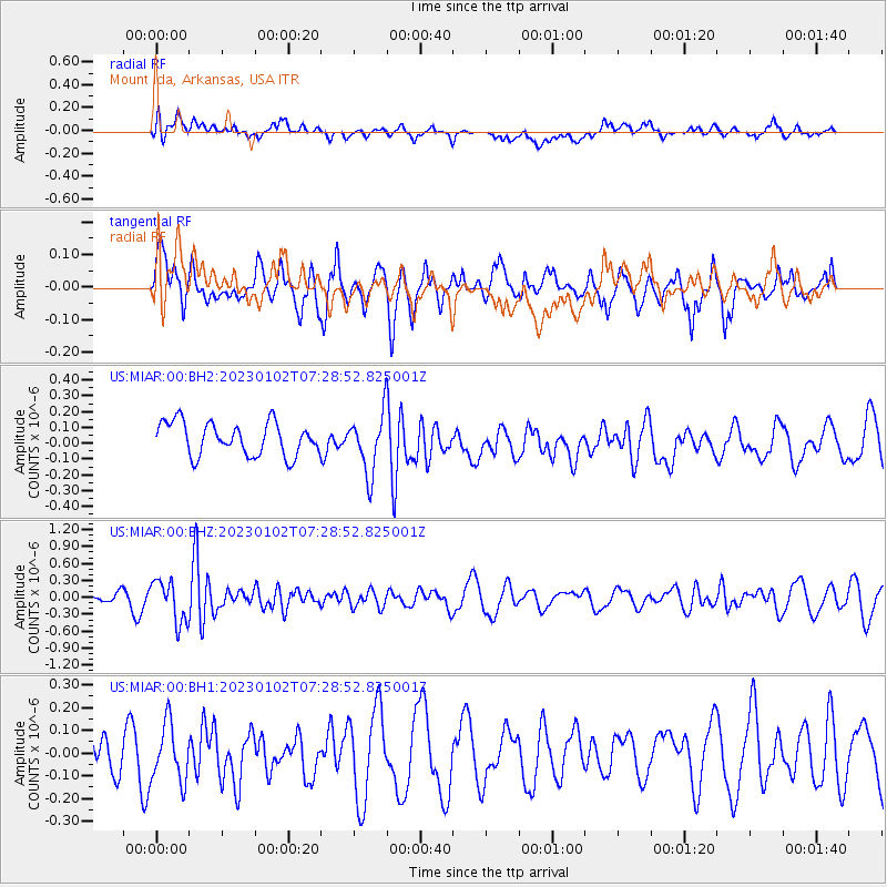
MIAR Mount Ida, Arkansas, USA - Earthquake Result Viewer
*The percent match for this event was below the threshold and hence no stack was calculated.
| Earthquake location: |
Azores Islands Region |
| Earthquake latitude/longitude: |
40.5/-29.4 |
| Earthquake time(UTC): |
2023/01/02 (002) 07:20:27 GMT |
| Earthquake Depth: |
10 km |
| Earthquake Magnitude: |
5.3 Mww |
| Earthquake Catalog/Contributor: |
NEIC PDE/us |
|
| Network: |
US United States National Seismic Network |
| Station: |
MIAR Mount Ida, Arkansas, USA |
| Lat/Lon: |
34.55 N/93.58 W |
| Elevation: |
207 m |
|
| Distance: |
50.3 deg |
| Az: |
284.964 deg |
| Baz: |
63.256 deg |
| Ray Param: |
$rayparam |
*The percent match for this event was below the threshold and hence was not used in the summary stack. |
|
| Radial Match: |
62.570835 % |
| Radial Bump: |
400 |
| Transverse Match: |
51.312943 % |
| Transverse Bump: |
381 |
| SOD ConfigId: |
29823551 |
| Insert Time: |
2023-01-16 07:42:32.632 +0000 |
| GWidth: |
2.5 |
| Max Bumps: |
400 |
| Tol: |
0.001 |
|
Signal To Noise
| Channel | StoN | STA | LTA |
| US:MIAR:00:BHZ:20230102T07:28:52.825001Z | 4.794167 | 3.696334E-7 | 7.710066E-8 |
| US:MIAR:00:BH1:20230102T07:28:52.825001Z | 1.0692433 | 1.2814253E-7 | 1.1984413E-7 |
| US:MIAR:00:BH2:20230102T07:28:52.825001Z | 1.8100479 | 1.8795456E-7 | 1.03839554E-7 |
| Arrivals |
| Ps | |
| PpPs | |
| PsPs/PpSs | |


