You are here: Home > Network List > US - United States National Seismic Network Stations List
> Station MSO Missoula, Montana, USA > Earthquake Result Viewer
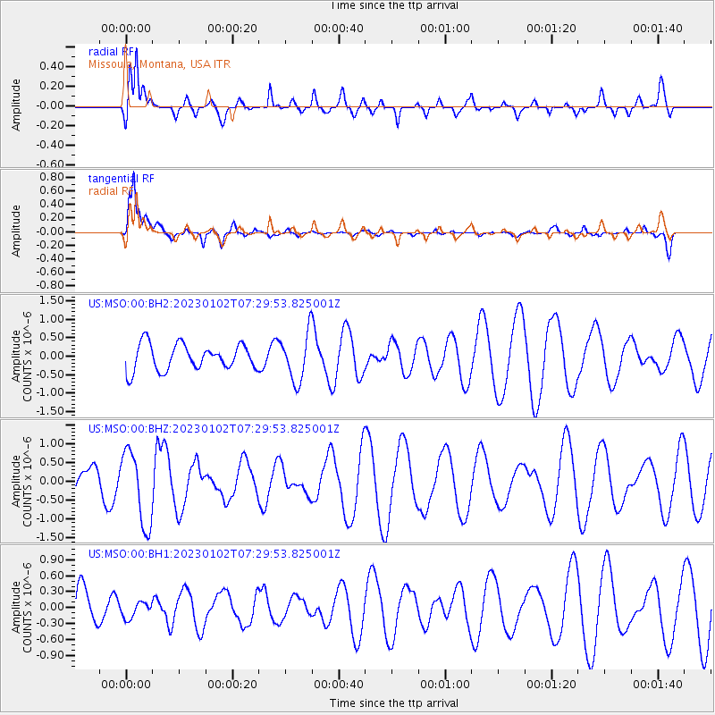
MSO Missoula, Montana, USA - Earthquake Result Viewer
*The percent match for this event was below the threshold and hence no stack was calculated.
| Earthquake location: |
Azores Islands Region |
| Earthquake latitude/longitude: |
40.5/-29.4 |
| Earthquake time(UTC): |
2023/01/02 (002) 07:20:27 GMT |
| Earthquake Depth: |
10 km |
| Earthquake Magnitude: |
5.3 Mww |
| Earthquake Catalog/Contributor: |
NEIC PDE/us |
|
| Network: |
US United States National Seismic Network |
| Station: |
MSO Missoula, Montana, USA |
| Lat/Lon: |
46.83 N/113.94 W |
| Elevation: |
1264 m |
|
| Distance: |
58.7 deg |
| Az: |
306.88 deg |
| Baz: |
62.736 deg |
| Ray Param: |
$rayparam |
*The percent match for this event was below the threshold and hence was not used in the summary stack. |
|
| Radial Match: |
62.595535 % |
| Radial Bump: |
400 |
| Transverse Match: |
79.94899 % |
| Transverse Bump: |
400 |
| SOD ConfigId: |
29823551 |
| Insert Time: |
2023-01-16 07:42:33.990 +0000 |
| GWidth: |
2.5 |
| Max Bumps: |
400 |
| Tol: |
0.001 |
|
Signal To Noise
| Channel | StoN | STA | LTA |
| US:MSO:00:BHZ:20230102T07:29:53.825001Z | 2.9380248 | 9.858142E-7 | 3.3553636E-7 |
| US:MSO:00:BH1:20230102T07:29:53.825001Z | 0.46752256 | 1.4872819E-7 | 3.1811982E-7 |
| US:MSO:00:BH2:20230102T07:29:53.825001Z | 1.8488264 | 6.503835E-7 | 3.5178184E-7 |
| Arrivals |
| Ps | |
| PpPs | |
| PsPs/PpSs | |


