You are here: Home > Network List > UW - Pacific Northwest Regional Seismic Network Stations List
> Station UMAT Pilot Rock, OR, USA > Earthquake Result Viewer
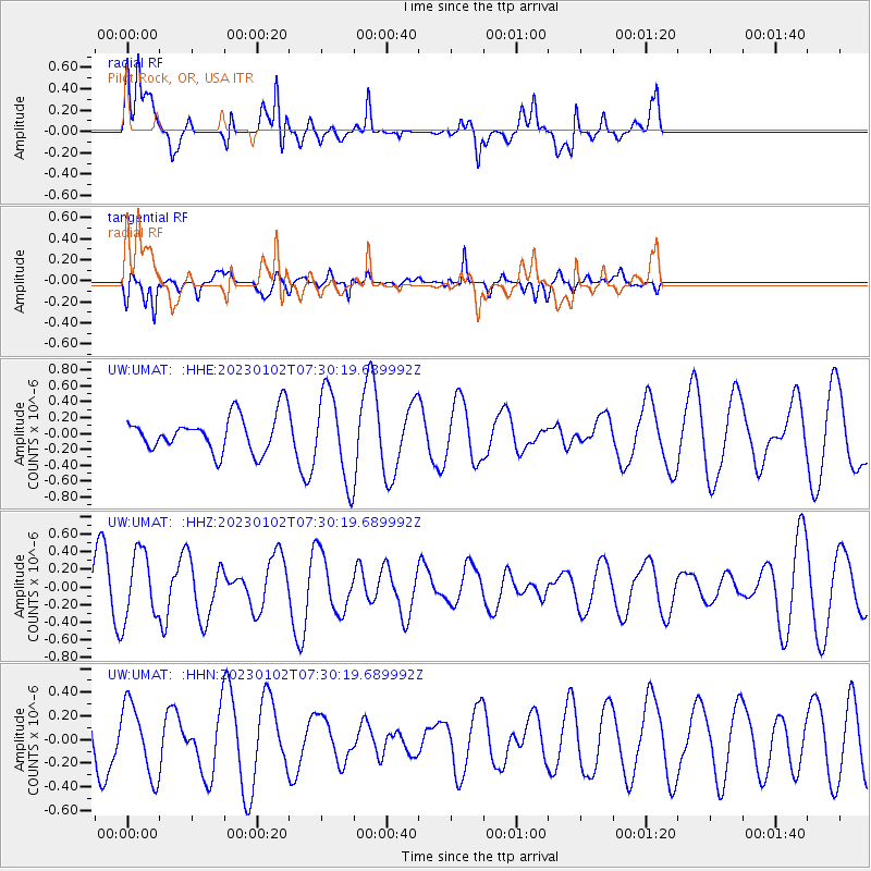
UMAT Pilot Rock, OR, USA - Earthquake Result Viewer
*The percent match for this event was below the threshold and hence no stack was calculated.
| Earthquake location: |
Azores Islands Region |
| Earthquake latitude/longitude: |
40.5/-29.4 |
| Earthquake time(UTC): |
2023/01/02 (002) 07:20:27 GMT |
| Earthquake Depth: |
10 km |
| Earthquake Magnitude: |
5.3 Mww |
| Earthquake Catalog/Contributor: |
NEIC PDE/us |
|
| Network: |
UW Pacific Northwest Regional Seismic Network |
| Station: |
UMAT Pilot Rock, OR, USA |
| Lat/Lon: |
45.29 N/118.96 W |
| Elevation: |
1318 m |
|
| Distance: |
62.5 deg |
| Az: |
307.278 deg |
| Baz: |
59.328 deg |
| Ray Param: |
$rayparam |
*The percent match for this event was below the threshold and hence was not used in the summary stack. |
|
| Radial Match: |
51.80902 % |
| Radial Bump: |
400 |
| Transverse Match: |
71.281944 % |
| Transverse Bump: |
400 |
| SOD ConfigId: |
29823551 |
| Insert Time: |
2023-01-16 07:44:17.196 +0000 |
| GWidth: |
2.5 |
| Max Bumps: |
400 |
| Tol: |
0.001 |
|
Signal To Noise
| Channel | StoN | STA | LTA |
| UW:UMAT: :HHZ:20230102T07:30:19.689992Z | 1.7777905 | 3.84427E-7 | 2.1623863E-7 |
| UW:UMAT: :HHN:20230102T07:30:19.689992Z | 1.4368916 | 3.0259935E-7 | 2.1059302E-7 |
| UW:UMAT: :HHE:20230102T07:30:19.689992Z | 2.395064 | 5.471206E-7 | 2.2843672E-7 |
| Arrivals |
| Ps | |
| PpPs | |
| PsPs/PpSs | |


