You are here: Home > Network List > TA - USArray Transportable Network (new EarthScope stations) Stations List
> Station R26A Arlington, CO, USA > Earthquake Result Viewer
R26A Arlington, CO, USA - Earthquake Result Viewer
*The percent match for this event was below the threshold and hence no stack was calculated.
| Earthquake location: |
Mariana Islands |
| Earthquake latitude/longitude: |
19.3/144.7 |
| Earthquake time(UTC): |
2010/03/08 (067) 09:47:11 GMT |
| Earthquake Depth: |
457 km |
| Earthquake Magnitude: |
6.0 MB, 6.1 MW, 6.1 MW |
| Earthquake Catalog/Contributor: |
WHDF/NEIC |
|
| Network: |
TA USArray Transportable Network (new EarthScope stations) |
| Station: |
R26A Arlington, CO, USA |
| Lat/Lon: |
38.30 N/103.45 W |
| Elevation: |
1304 m |
|
| Distance: |
94.2 deg |
| Az: |
47.077 deg |
| Baz: |
298.49 deg |
| Ray Param: |
$rayparam |
*The percent match for this event was below the threshold and hence was not used in the summary stack. |
|
| Radial Match: |
50.67709 % |
| Radial Bump: |
400 |
| Transverse Match: |
55.170967 % |
| Transverse Bump: |
400 |
| SOD ConfigId: |
299721 |
| Insert Time: |
2010-04-26 19:52:06.742 +0000 |
| GWidth: |
2.5 |
| Max Bumps: |
400 |
| Tol: |
0.001 |
|
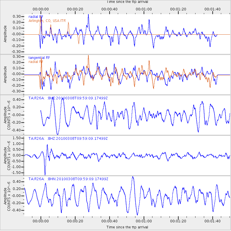
Signal To Noise
| Channel | StoN | STA | LTA |
| TA:R26A: :BHZ:20100308T09:59:09.17499Z | 3.4664836 | 5.907953E-7 | 1.7043072E-7 |
| TA:R26A: :BHN:20100308T09:59:09.17499Z | 1.2984954 | 2.0400793E-7 | 1.5711102E-7 |
| TA:R26A: :BHE:20100308T09:59:09.17499Z | 0.7669433 | 1.8209295E-7 | 2.3742687E-7 |
| Arrivals |
| Ps | |
| PpPs | |
| PsPs/PpSs | |


