You are here: Home > Network List > TA - USArray Transportable Network (new EarthScope stations) Stations List
> Station R29A Marienthal, KS, USA > Earthquake Result Viewer
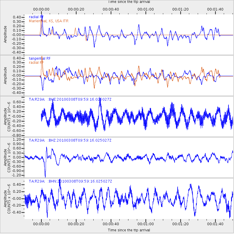
R29A Marienthal, KS, USA - Earthquake Result Viewer
*The percent match for this event was below the threshold and hence no stack was calculated.
| Earthquake location: |
Mariana Islands |
| Earthquake latitude/longitude: |
19.3/144.7 |
| Earthquake time(UTC): |
2010/03/08 (067) 09:47:11 GMT |
| Earthquake Depth: |
457 km |
| Earthquake Magnitude: |
6.0 MB, 6.1 MW, 6.1 MW |
| Earthquake Catalog/Contributor: |
WHDF/NEIC |
|
| Network: |
TA USArray Transportable Network (new EarthScope stations) |
| Station: |
R29A Marienthal, KS, USA |
| Lat/Lon: |
38.42 N/101.14 W |
| Elevation: |
957 m |
|
| Distance: |
95.7 deg |
| Az: |
46.079 deg |
| Baz: |
300.004 deg |
| Ray Param: |
$rayparam |
*The percent match for this event was below the threshold and hence was not used in the summary stack. |
|
| Radial Match: |
59.60186 % |
| Radial Bump: |
400 |
| Transverse Match: |
65.36298 % |
| Transverse Bump: |
400 |
| SOD ConfigId: |
299721 |
| Insert Time: |
2010-04-26 19:54:46.043 +0000 |
| GWidth: |
2.5 |
| Max Bumps: |
400 |
| Tol: |
0.001 |
|
Signal To Noise
| Channel | StoN | STA | LTA |
| TA:R29A: :BHZ:20100308T09:59:16.025027Z | 2.8623712 | 4.281929E-7 | 1.4959376E-7 |
| TA:R29A: :BHN:20100308T09:59:16.025027Z | 1.2672278 | 1.891791E-7 | 1.4928578E-7 |
| TA:R29A: :BHE:20100308T09:59:16.025027Z | 1.8018607 | 3.6916882E-7 | 2.0488199E-7 |
| Arrivals |
| Ps | |
| PpPs | |
| PsPs/PpSs | |


