You are here: Home > Network List > TA - USArray Transportable Network (new EarthScope stations) Stations List
> Station P29A Atwood, KS, USA > Earthquake Result Viewer
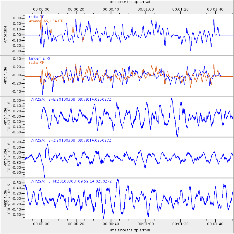
P29A Atwood, KS, USA - Earthquake Result Viewer
*The percent match for this event was below the threshold and hence no stack was calculated.
| Earthquake location: |
Mariana Islands |
| Earthquake latitude/longitude: |
19.3/144.7 |
| Earthquake time(UTC): |
2010/03/08 (067) 09:47:11 GMT |
| Earthquake Depth: |
457 km |
| Earthquake Magnitude: |
6.0 MB, 6.1 MW, 6.1 MW |
| Earthquake Catalog/Contributor: |
WHDF/NEIC |
|
| Network: |
TA USArray Transportable Network (new EarthScope stations) |
| Station: |
P29A Atwood, KS, USA |
| Lat/Lon: |
39.60 N/100.93 W |
| Elevation: |
929 m |
|
| Distance: |
95.3 deg |
| Az: |
44.976 deg |
| Baz: |
300.239 deg |
| Ray Param: |
$rayparam |
*The percent match for this event was below the threshold and hence was not used in the summary stack. |
|
| Radial Match: |
50.598637 % |
| Radial Bump: |
400 |
| Transverse Match: |
69.886734 % |
| Transverse Bump: |
400 |
| SOD ConfigId: |
299721 |
| Insert Time: |
2010-04-26 19:55:17.350 +0000 |
| GWidth: |
2.5 |
| Max Bumps: |
400 |
| Tol: |
0.001 |
|
Signal To Noise
| Channel | StoN | STA | LTA |
| TA:P29A: :BHZ:20100308T09:59:14.025027Z | 5.4905815 | 5.306283E-7 | 9.6643376E-8 |
| TA:P29A: :BHN:20100308T09:59:14.025027Z | 0.7253496 | 1.8189445E-7 | 2.5076798E-7 |
| TA:P29A: :BHE:20100308T09:59:14.025027Z | 1.5723555 | 2.8453073E-7 | 1.8095827E-7 |
| Arrivals |
| Ps | |
| PpPs | |
| PsPs/PpSs | |


