You are here: Home > Network List > TA - USArray Transportable Network (new EarthScope stations) Stations List
> Station L02D Cave Junction, OR, USA > Earthquake Result Viewer
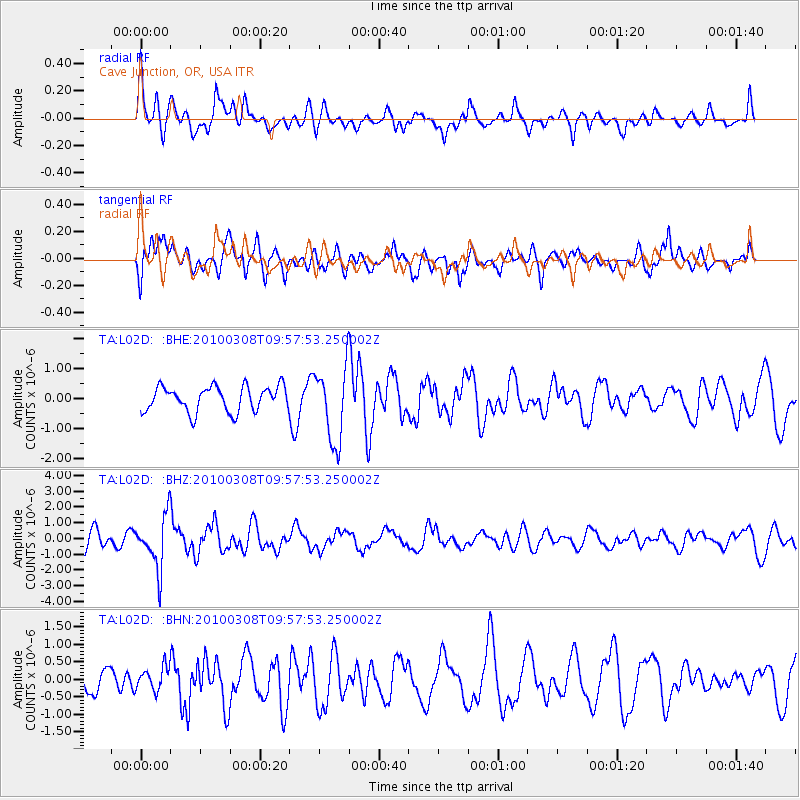
L02D Cave Junction, OR, USA - Earthquake Result Viewer
*The percent match for this event was below the threshold and hence no stack was calculated.
| Earthquake location: |
Mariana Islands |
| Earthquake latitude/longitude: |
19.3/144.7 |
| Earthquake time(UTC): |
2010/03/08 (067) 09:47:11 GMT |
| Earthquake Depth: |
457 km |
| Earthquake Magnitude: |
6.0 MB, 6.1 MW, 6.1 MW |
| Earthquake Catalog/Contributor: |
WHDF/NEIC |
|
| Network: |
TA USArray Transportable Network (new EarthScope stations) |
| Station: |
L02D Cave Junction, OR, USA |
| Lat/Lon: |
42.16 N/123.60 W |
| Elevation: |
458 m |
|
| Distance: |
78.5 deg |
| Az: |
49.326 deg |
| Baz: |
285.582 deg |
| Ray Param: |
$rayparam |
*The percent match for this event was below the threshold and hence was not used in the summary stack. |
|
| Radial Match: |
66.002335 % |
| Radial Bump: |
400 |
| Transverse Match: |
63.47068 % |
| Transverse Bump: |
400 |
| SOD ConfigId: |
299721 |
| Insert Time: |
2010-04-26 20:03:17.914 +0000 |
| GWidth: |
2.5 |
| Max Bumps: |
400 |
| Tol: |
0.001 |
|
Signal To Noise
| Channel | StoN | STA | LTA |
| TA:L02D: :BHZ:20100308T09:57:53.250002Z | 3.5777419 | 1.6653535E-6 | 4.6547612E-7 |
| TA:L02D: :BHN:20100308T09:57:53.250002Z | 0.98801804 | 3.216629E-7 | 3.2556378E-7 |
| TA:L02D: :BHE:20100308T09:57:53.250002Z | 2.9805224 | 1.2487345E-6 | 4.1896496E-7 |
| Arrivals |
| Ps | |
| PpPs | |
| PsPs/PpSs | |


