You are here: Home > Network List > US - United States National Seismic Network Stations List
> Station HAWA Hanford, Washington, USA > Earthquake Result Viewer
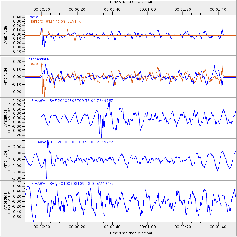
HAWA Hanford, Washington, USA - Earthquake Result Viewer
*The percent match for this event was below the threshold and hence no stack was calculated.
| Earthquake location: |
Mariana Islands |
| Earthquake latitude/longitude: |
19.3/144.7 |
| Earthquake time(UTC): |
2010/03/08 (067) 09:47:11 GMT |
| Earthquake Depth: |
457 km |
| Earthquake Magnitude: |
6.0 MB, 6.1 MW, 6.1 MW |
| Earthquake Catalog/Contributor: |
WHDF/NEIC |
|
| Network: |
US United States National Seismic Network |
| Station: |
HAWA Hanford, Washington, USA |
| Lat/Lon: |
46.39 N/119.53 W |
| Elevation: |
364 m |
|
| Distance: |
80.1 deg |
| Az: |
44.351 deg |
| Baz: |
287.492 deg |
| Ray Param: |
$rayparam |
*The percent match for this event was below the threshold and hence was not used in the summary stack. |
|
| Radial Match: |
55.53522 % |
| Radial Bump: |
400 |
| Transverse Match: |
52.902584 % |
| Transverse Bump: |
400 |
| SOD ConfigId: |
299721 |
| Insert Time: |
2010-04-26 20:04:39.808 +0000 |
| GWidth: |
2.5 |
| Max Bumps: |
400 |
| Tol: |
0.001 |
|
Signal To Noise
| Channel | StoN | STA | LTA |
| US:HAWA: :BHZ:20100308T09:58:01.724978Z | 4.324526 | 1.5286719E-6 | 3.5348887E-7 |
| US:HAWA: :BHN:20100308T09:58:01.724978Z | 0.8875204 | 2.8871054E-7 | 3.253002E-7 |
| US:HAWA: :BHE:20100308T09:58:01.724978Z | 2.4678507 | 5.6290907E-7 | 2.2809688E-7 |
| Arrivals |
| Ps | |
| PpPs | |
| PsPs/PpSs | |


