You are here: Home > Network List > US - United States National Seismic Network Stations List
> Station DGMT Dagmar, Montana, USA > Earthquake Result Viewer
DGMT Dagmar, Montana, USA - Earthquake Result Viewer
*The percent match for this event was below the threshold and hence no stack was calculated.
| Earthquake location: |
Mariana Islands |
| Earthquake latitude/longitude: |
19.3/144.7 |
| Earthquake time(UTC): |
2010/03/08 (067) 09:47:11 GMT |
| Earthquake Depth: |
457 km |
| Earthquake Magnitude: |
6.0 MB, 6.1 MW, 6.1 MW |
| Earthquake Catalog/Contributor: |
WHDF/NEIC |
|
| Network: |
US United States National Seismic Network |
| Station: |
DGMT Dagmar, Montana, USA |
| Lat/Lon: |
48.47 N/104.20 W |
| Elevation: |
0.0 m |
|
| Distance: |
88.9 deg |
| Az: |
38.39 deg |
| Baz: |
298.212 deg |
| Ray Param: |
$rayparam |
*The percent match for this event was below the threshold and hence was not used in the summary stack. |
|
| Radial Match: |
61.191856 % |
| Radial Bump: |
370 |
| Transverse Match: |
73.42493 % |
| Transverse Bump: |
382 |
| SOD ConfigId: |
299721 |
| Insert Time: |
2010-04-26 20:05:20.491 +0000 |
| GWidth: |
2.5 |
| Max Bumps: |
400 |
| Tol: |
0.001 |
|
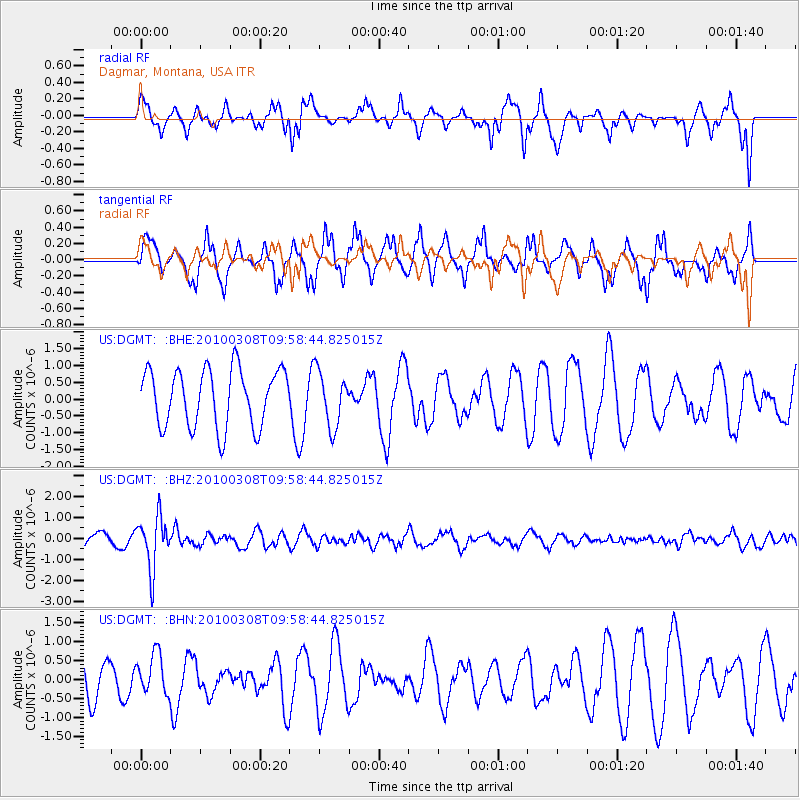
Signal To Noise
| Channel | StoN | STA | LTA |
| US:DGMT: :BHZ:20100308T09:58:44.825015Z | 3.5122273 | 1.2267915E-6 | 3.492916E-7 |
| US:DGMT: :BHN:20100308T09:58:44.825015Z | 0.7795542 | 5.2798873E-7 | 6.7729576E-7 |
| US:DGMT: :BHE:20100308T09:58:44.825015Z | 0.95649916 | 8.181228E-7 | 8.553304E-7 |
| Arrivals |
| Ps | |
| PpPs | |
| PsPs/PpSs | |


