You are here: Home > Network List > IU - Global Seismograph Network (GSN - IRIS/USGS) Stations List
> Station PMG Port Moresby, New Guinea > Earthquake Result Viewer
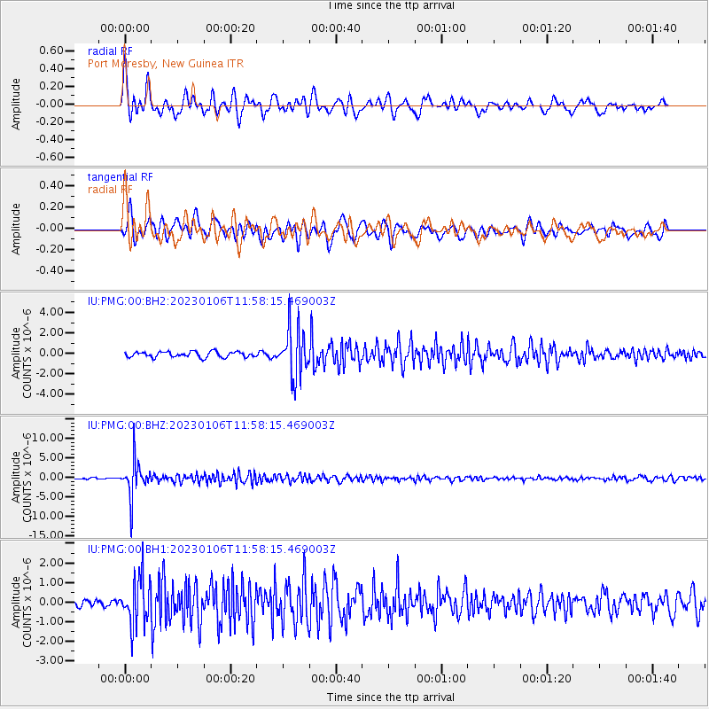
PMG Port Moresby, New Guinea - Earthquake Result Viewer
*The percent match for this event was below the threshold and hence no stack was calculated.
| Earthquake location: |
South Of Fiji Islands |
| Earthquake latitude/longitude: |
-24.8/-179.9 |
| Earthquake time(UTC): |
2023/01/06 (006) 11:52:37 GMT |
| Earthquake Depth: |
505 km |
| Earthquake Magnitude: |
5.9 Mww |
| Earthquake Catalog/Contributor: |
NEIC PDE/us |
|
| Network: |
IU Global Seismograph Network (GSN - IRIS/USGS) |
| Station: |
PMG Port Moresby, New Guinea |
| Lat/Lon: |
9.40 S/147.16 E |
| Elevation: |
90 m |
|
| Distance: |
34.8 deg |
| Az: |
290.224 deg |
| Baz: |
120.163 deg |
| Ray Param: |
$rayparam |
*The percent match for this event was below the threshold and hence was not used in the summary stack. |
|
| Radial Match: |
80.65087 % |
| Radial Bump: |
400 |
| Transverse Match: |
81.19091 % |
| Transverse Bump: |
400 |
| SOD ConfigId: |
29823551 |
| Insert Time: |
2023-01-20 12:03:52.040 +0000 |
| GWidth: |
2.5 |
| Max Bumps: |
400 |
| Tol: |
0.001 |
|
Signal To Noise
| Channel | StoN | STA | LTA |
| IU:PMG:00:BHZ:20230106T11:58:15.469003Z | 24.359903 | 4.641472E-6 | 1.9053739E-7 |
| IU:PMG:00:BH1:20230106T11:58:15.469003Z | 8.021224 | 1.1878444E-6 | 1.4808768E-7 |
| IU:PMG:00:BH2:20230106T11:58:15.469003Z | 8.683979 | 2.383262E-6 | 2.7444355E-7 |
| Arrivals |
| Ps | |
| PpPs | |
| PsPs/PpSs | |


