You are here: Home > Network List > TA - USArray Transportable Network (new EarthScope stations) Stations List
> Station T27A Campo, CO, USA > Earthquake Result Viewer
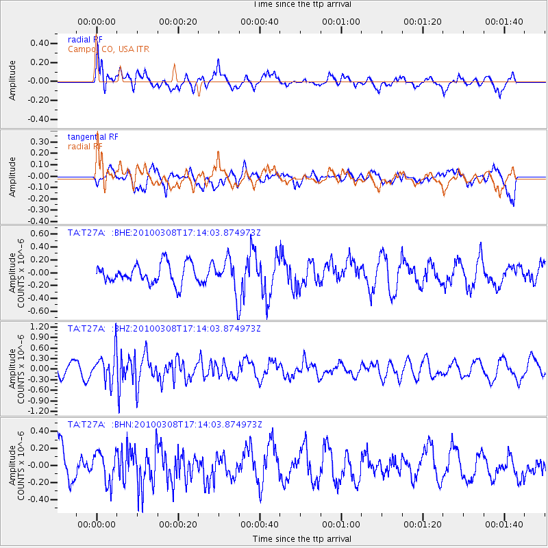
T27A Campo, CO, USA - Earthquake Result Viewer
*The percent match for this event was below the threshold and hence no stack was calculated.
| Earthquake location: |
Salta Province, Argentina |
| Earthquake latitude/longitude: |
-25.7/-66.6 |
| Earthquake time(UTC): |
2010/03/08 (067) 17:03:16 GMT |
| Earthquake Depth: |
10 km |
| Earthquake Magnitude: |
5.6 MB, 5.5 MS, 5.8 MW |
| Earthquake Catalog/Contributor: |
WHDF/NEIC |
|
| Network: |
TA USArray Transportable Network (new EarthScope stations) |
| Station: |
T27A Campo, CO, USA |
| Lat/Lon: |
37.06 N/102.72 W |
| Elevation: |
1366 m |
|
| Distance: |
71.1 deg |
| Az: |
330.116 deg |
| Baz: |
145.812 deg |
| Ray Param: |
$rayparam |
*The percent match for this event was below the threshold and hence was not used in the summary stack. |
|
| Radial Match: |
59.866116 % |
| Radial Bump: |
400 |
| Transverse Match: |
57.70447 % |
| Transverse Bump: |
400 |
| SOD ConfigId: |
299721 |
| Insert Time: |
2010-04-26 20:14:32.649 +0000 |
| GWidth: |
2.5 |
| Max Bumps: |
400 |
| Tol: |
0.001 |
|
Signal To Noise
| Channel | StoN | STA | LTA |
| TA:T27A: :BHZ:20100308T17:14:03.874973Z | 2.9428213 | 4.2841998E-7 | 1.4558138E-7 |
| TA:T27A: :BHN:20100308T17:14:03.874973Z | 0.9536007 | 1.816455E-7 | 1.9048382E-7 |
| TA:T27A: :BHE:20100308T17:14:03.874973Z | 1.773256 | 2.6920327E-7 | 1.5181298E-7 |
| Arrivals |
| Ps | |
| PpPs | |
| PsPs/PpSs | |


