You are here: Home > Network List > TA - USArray Transportable Network (new EarthScope stations) Stations List
> Station 431A Sonora, TX, USA > Earthquake Result Viewer
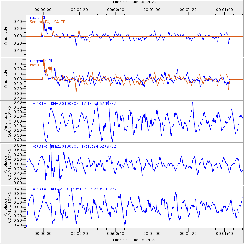
431A Sonora, TX, USA - Earthquake Result Viewer
*The percent match for this event was below the threshold and hence no stack was calculated.
| Earthquake location: |
Salta Province, Argentina |
| Earthquake latitude/longitude: |
-25.7/-66.6 |
| Earthquake time(UTC): |
2010/03/08 (067) 17:03:16 GMT |
| Earthquake Depth: |
10 km |
| Earthquake Magnitude: |
5.6 MB, 5.5 MS, 5.8 MW |
| Earthquake Catalog/Contributor: |
WHDF/NEIC |
|
| Network: |
TA USArray Transportable Network (new EarthScope stations) |
| Station: |
431A Sonora, TX, USA |
| Lat/Lon: |
30.68 N/100.61 W |
| Elevation: |
700 m |
|
| Distance: |
64.8 deg |
| Az: |
327.849 deg |
| Baz: |
146.134 deg |
| Ray Param: |
$rayparam |
*The percent match for this event was below the threshold and hence was not used in the summary stack. |
|
| Radial Match: |
42.685463 % |
| Radial Bump: |
400 |
| Transverse Match: |
55.423702 % |
| Transverse Bump: |
400 |
| SOD ConfigId: |
299721 |
| Insert Time: |
2010-04-26 20:16:03.766 +0000 |
| GWidth: |
2.5 |
| Max Bumps: |
400 |
| Tol: |
0.001 |
|
Signal To Noise
| Channel | StoN | STA | LTA |
| TA:431A: :BHZ:20100308T17:13:24.624973Z | 2.4814398 | 3.832851E-7 | 1.5446078E-7 |
| TA:431A: :BHN:20100308T17:13:24.624973Z | 0.51131606 | 1.1138262E-7 | 2.1783517E-7 |
| TA:431A: :BHE:20100308T17:13:24.624973Z | 1.5512265 | 2.5880948E-7 | 1.6684184E-7 |
| Arrivals |
| Ps | |
| PpPs | |
| PsPs/PpSs | |


