You are here: Home > Network List > TA - USArray Transportable Network (new EarthScope stations) Stations List
> Station 432A Menard, TX, USA > Earthquake Result Viewer
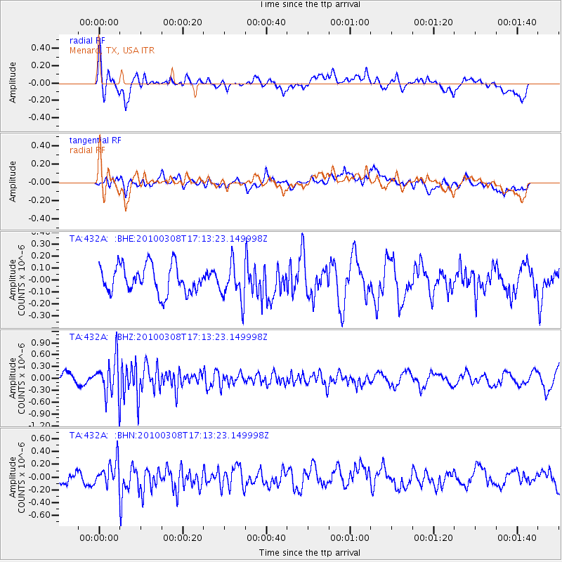
432A Menard, TX, USA - Earthquake Result Viewer
*The percent match for this event was below the threshold and hence no stack was calculated.
| Earthquake location: |
Salta Province, Argentina |
| Earthquake latitude/longitude: |
-25.7/-66.6 |
| Earthquake time(UTC): |
2010/03/08 (067) 17:03:16 GMT |
| Earthquake Depth: |
10 km |
| Earthquake Magnitude: |
5.6 MB, 5.5 MS, 5.8 MW |
| Earthquake Catalog/Contributor: |
WHDF/NEIC |
|
| Network: |
TA USArray Transportable Network (new EarthScope stations) |
| Station: |
432A Menard, TX, USA |
| Lat/Lon: |
30.88 N/99.79 W |
| Elevation: |
647 m |
|
| Distance: |
64.6 deg |
| Az: |
328.613 deg |
| Baz: |
146.875 deg |
| Ray Param: |
$rayparam |
*The percent match for this event was below the threshold and hence was not used in the summary stack. |
|
| Radial Match: |
59.16871 % |
| Radial Bump: |
400 |
| Transverse Match: |
45.678238 % |
| Transverse Bump: |
400 |
| SOD ConfigId: |
299721 |
| Insert Time: |
2010-04-26 20:16:19.426 +0000 |
| GWidth: |
2.5 |
| Max Bumps: |
400 |
| Tol: |
0.001 |
|
Signal To Noise
| Channel | StoN | STA | LTA |
| TA:432A: :BHZ:20100308T17:13:23.149998Z | 2.2709618 | 4.821112E-7 | 2.1229386E-7 |
| TA:432A: :BHN:20100308T17:13:23.149998Z | 1.7248613 | 1.7931721E-7 | 1.0396037E-7 |
| TA:432A: :BHE:20100308T17:13:23.149998Z | 1.3350083 | 1.5341737E-7 | 1.1491868E-7 |
| Arrivals |
| Ps | |
| PpPs | |
| PsPs/PpSs | |


