You are here: Home > Network List > TA - USArray Transportable Network (new EarthScope stations) Stations List
> Station S28A Manter, KS, USA > Earthquake Result Viewer
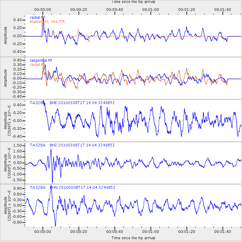
S28A Manter, KS, USA - Earthquake Result Viewer
*The percent match for this event was below the threshold and hence no stack was calculated.
| Earthquake location: |
Salta Province, Argentina |
| Earthquake latitude/longitude: |
-25.7/-66.6 |
| Earthquake time(UTC): |
2010/03/08 (067) 17:03:16 GMT |
| Earthquake Depth: |
10 km |
| Earthquake Magnitude: |
5.6 MB, 5.5 MS, 5.8 MW |
| Earthquake Catalog/Contributor: |
WHDF/NEIC |
|
| Network: |
TA USArray Transportable Network (new EarthScope stations) |
| Station: |
S28A Manter, KS, USA |
| Lat/Lon: |
37.59 N/101.90 W |
| Elevation: |
1064 m |
|
| Distance: |
71.2 deg |
| Az: |
331.002 deg |
| Baz: |
146.596 deg |
| Ray Param: |
$rayparam |
*The percent match for this event was below the threshold and hence was not used in the summary stack. |
|
| Radial Match: |
49.762115 % |
| Radial Bump: |
400 |
| Transverse Match: |
42.16698 % |
| Transverse Bump: |
400 |
| SOD ConfigId: |
299721 |
| Insert Time: |
2010-04-26 20:18:33.707 +0000 |
| GWidth: |
2.5 |
| Max Bumps: |
400 |
| Tol: |
0.001 |
|
Signal To Noise
| Channel | StoN | STA | LTA |
| TA:S28A: :BHZ:20100308T17:14:04.324985Z | 3.8419743 | 4.2906277E-7 | 1.1167768E-7 |
| TA:S28A: :BHN:20100308T17:14:04.324985Z | 1.8120264 | 4.6189965E-7 | 2.5490777E-7 |
| TA:S28A: :BHE:20100308T17:14:04.324985Z | 1.6778487 | 2.762365E-7 | 1.6463731E-7 |
| Arrivals |
| Ps | |
| PpPs | |
| PsPs/PpSs | |


