You are here: Home > Network List > TA - USArray Transportable Network (new EarthScope stations) Stations List
> Station Q30A Quinter, KS, USA > Earthquake Result Viewer
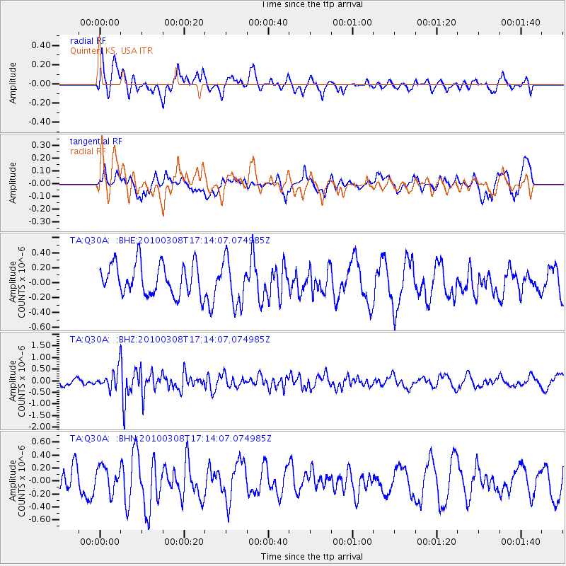
Q30A Quinter, KS, USA - Earthquake Result Viewer
*The percent match for this event was below the threshold and hence no stack was calculated.
| Earthquake location: |
Salta Province, Argentina |
| Earthquake latitude/longitude: |
-25.7/-66.6 |
| Earthquake time(UTC): |
2010/03/08 (067) 17:03:16 GMT |
| Earthquake Depth: |
10 km |
| Earthquake Magnitude: |
5.6 MB, 5.5 MS, 5.8 MW |
| Earthquake Catalog/Contributor: |
WHDF/NEIC |
|
| Network: |
TA USArray Transportable Network (new EarthScope stations) |
| Station: |
Q30A Quinter, KS, USA |
| Lat/Lon: |
38.98 N/100.22 W |
| Elevation: |
797 m |
|
| Distance: |
71.6 deg |
| Az: |
332.963 deg |
| Baz: |
148.257 deg |
| Ray Param: |
$rayparam |
*The percent match for this event was below the threshold and hence was not used in the summary stack. |
|
| Radial Match: |
51.83208 % |
| Radial Bump: |
400 |
| Transverse Match: |
58.61334 % |
| Transverse Bump: |
400 |
| SOD ConfigId: |
299721 |
| Insert Time: |
2010-04-26 20:18:53.004 +0000 |
| GWidth: |
2.5 |
| Max Bumps: |
400 |
| Tol: |
0.001 |
|
Signal To Noise
| Channel | StoN | STA | LTA |
| TA:Q30A: :BHZ:20100308T17:14:07.074985Z | 2.272552 | 4.3182126E-7 | 1.9001601E-7 |
| TA:Q30A: :BHN:20100308T17:14:07.074985Z | 0.9296485 | 1.9197059E-7 | 2.0649803E-7 |
| TA:Q30A: :BHE:20100308T17:14:07.074985Z | 1.472697 | 3.0731243E-7 | 2.0867323E-7 |
| Arrivals |
| Ps | |
| PpPs | |
| PsPs/PpSs | |


