You are here: Home > Network List > TA - USArray Transportable Network (new EarthScope stations) Stations List
> Station N29A Votaw Ranch, Wellfleet, NE, USA > Earthquake Result Viewer
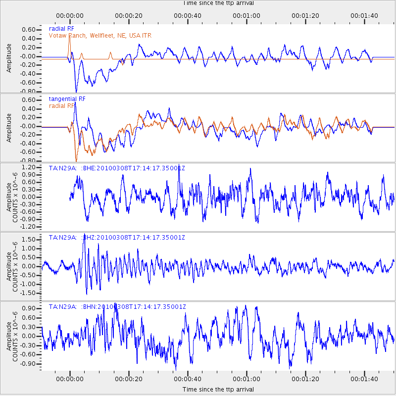
N29A Votaw Ranch, Wellfleet, NE, USA - Earthquake Result Viewer
*The percent match for this event was below the threshold and hence no stack was calculated.
| Earthquake location: |
Salta Province, Argentina |
| Earthquake latitude/longitude: |
-25.7/-66.6 |
| Earthquake time(UTC): |
2010/03/08 (067) 17:03:16 GMT |
| Earthquake Depth: |
10 km |
| Earthquake Magnitude: |
5.6 MB, 5.5 MS, 5.8 MW |
| Earthquake Catalog/Contributor: |
WHDF/NEIC |
|
| Network: |
TA USArray Transportable Network (new EarthScope stations) |
| Station: |
N29A Votaw Ranch, Wellfleet, NE, USA |
| Lat/Lon: |
40.82 N/100.63 W |
| Elevation: |
897 m |
|
| Distance: |
73.3 deg |
| Az: |
333.7 deg |
| Baz: |
148.219 deg |
| Ray Param: |
$rayparam |
*The percent match for this event was below the threshold and hence was not used in the summary stack. |
|
| Radial Match: |
46.159508 % |
| Radial Bump: |
400 |
| Transverse Match: |
63.01728 % |
| Transverse Bump: |
400 |
| SOD ConfigId: |
299721 |
| Insert Time: |
2010-04-26 20:19:22.643 +0000 |
| GWidth: |
2.5 |
| Max Bumps: |
400 |
| Tol: |
0.001 |
|
Signal To Noise
| Channel | StoN | STA | LTA |
| TA:N29A: :BHZ:20100308T17:14:17.35001Z | 3.5490344 | 5.579269E-7 | 1.5720528E-7 |
| TA:N29A: :BHN:20100308T17:14:17.35001Z | 0.3818015 | 1.5704816E-7 | 4.1133458E-7 |
| TA:N29A: :BHE:20100308T17:14:17.35001Z | 0.8980005 | 3.655886E-7 | 4.0711404E-7 |
| Arrivals |
| Ps | |
| PpPs | |
| PsPs/PpSs | |


