You are here: Home > Network List > US - United States National Seismic Network Stations List
> Station AMTX Amarillo, Texas, USA > Earthquake Result Viewer
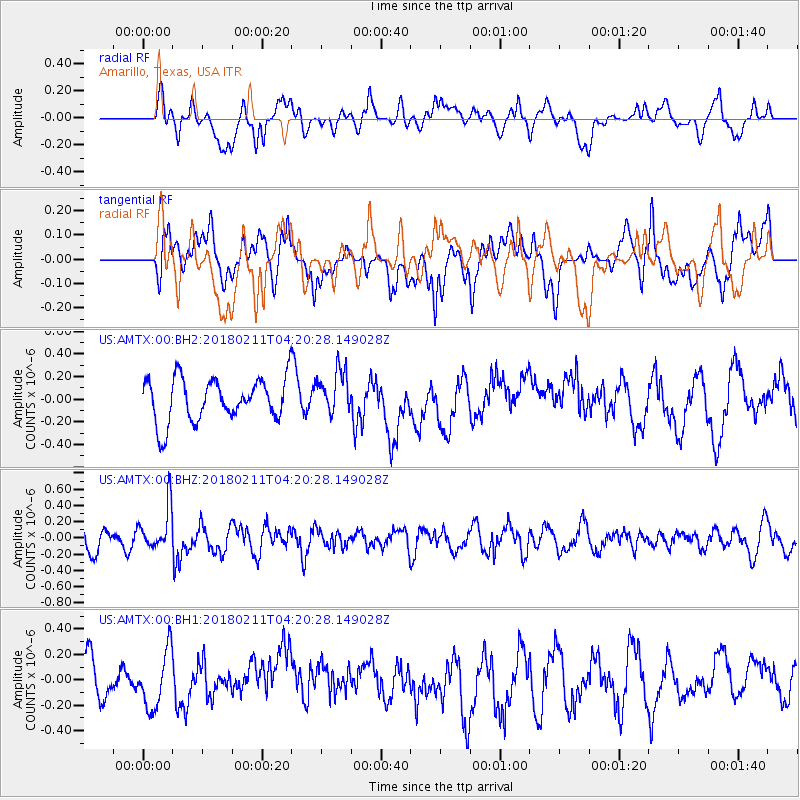
AMTX Amarillo, Texas, USA - Earthquake Result Viewer
*The percent match for this event was below the threshold and hence no stack was calculated.
| Earthquake location: |
Near Coast Of Peru |
| Earthquake latitude/longitude: |
-16.7/-74.2 |
| Earthquake time(UTC): |
2018/02/11 (042) 04:11:09 GMT |
| Earthquake Depth: |
10 km |
| Earthquake Magnitude: |
5.4 Mww |
| Earthquake Catalog/Contributor: |
NEIC PDE/us |
|
| Network: |
US United States National Seismic Network |
| Station: |
AMTX Amarillo, Texas, USA |
| Lat/Lon: |
34.53 N/101.41 W |
| Elevation: |
1010 m |
|
| Distance: |
57.2 deg |
| Az: |
333.26 deg |
| Baz: |
148.511 deg |
| Ray Param: |
$rayparam |
*The percent match for this event was below the threshold and hence was not used in the summary stack. |
|
| Radial Match: |
56.20533 % |
| Radial Bump: |
400 |
| Transverse Match: |
47.78758 % |
| Transverse Bump: |
400 |
| SOD ConfigId: |
2973751 |
| Insert Time: |
2018-10-09 07:59:59.338 +0000 |
| GWidth: |
2.5 |
| Max Bumps: |
400 |
| Tol: |
0.001 |
|
Signal To Noise
| Channel | StoN | STA | LTA |
| US:AMTX:00:BHZ:20180211T04:20:28.149028Z | 1.3913146 | 2.6799123E-7 | 1.9261726E-7 |
| US:AMTX:00:BH1:20180211T04:20:28.149028Z | 1.347667 | 2.2086667E-7 | 1.6388816E-7 |
| US:AMTX:00:BH2:20180211T04:20:28.149028Z | 0.64771307 | 1.1875801E-7 | 1.8334973E-7 |
| Arrivals |
| Ps | |
| PpPs | |
| PsPs/PpSs | |


