You are here: Home > Network List > TA - USArray Transportable Network (new EarthScope stations) Stations List
> Station 339A Huntington, TX, USA > Earthquake Result Viewer
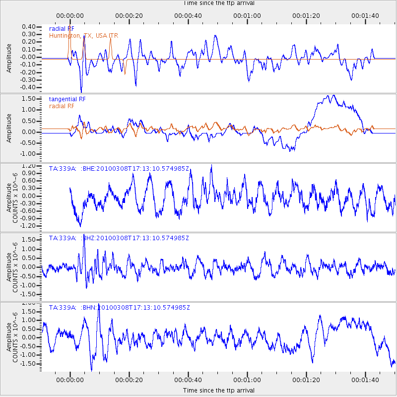
339A Huntington, TX, USA - Earthquake Result Viewer
*The percent match for this event was below the threshold and hence no stack was calculated.
| Earthquake location: |
Salta Province, Argentina |
| Earthquake latitude/longitude: |
-25.7/-66.6 |
| Earthquake time(UTC): |
2010/03/08 (067) 17:03:16 GMT |
| Earthquake Depth: |
10 km |
| Earthquake Magnitude: |
5.6 MB, 5.5 MS, 5.8 MW |
| Earthquake Catalog/Contributor: |
WHDF/NEIC |
|
| Network: |
TA USArray Transportable Network (new EarthScope stations) |
| Station: |
339A Huntington, TX, USA |
| Lat/Lon: |
31.33 N/94.56 W |
| Elevation: |
82 m |
|
| Distance: |
62.7 deg |
| Az: |
333.181 deg |
| Baz: |
151.598 deg |
| Ray Param: |
$rayparam |
*The percent match for this event was below the threshold and hence was not used in the summary stack. |
|
| Radial Match: |
42.26683 % |
| Radial Bump: |
400 |
| Transverse Match: |
26.527079 % |
| Transverse Bump: |
400 |
| SOD ConfigId: |
299721 |
| Insert Time: |
2010-04-26 20:27:30.336 +0000 |
| GWidth: |
2.5 |
| Max Bumps: |
400 |
| Tol: |
0.001 |
|
Signal To Noise
| Channel | StoN | STA | LTA |
| TA:339A: :BHZ:20100308T17:13:10.574985Z | 2.0045793 | 5.357538E-7 | 2.6726497E-7 |
| TA:339A: :BHN:20100308T17:13:10.574985Z | 0.9367763 | 4.603801E-7 | 4.914515E-7 |
| TA:339A: :BHE:20100308T17:13:10.574985Z | 1.3494098 | 5.41143E-7 | 4.01022E-7 |
| Arrivals |
| Ps | |
| PpPs | |
| PsPs/PpSs | |


