You are here: Home > Network List > US - United States National Seismic Network Stations List
> Station DGMT Dagmar, Montana, USA > Earthquake Result Viewer
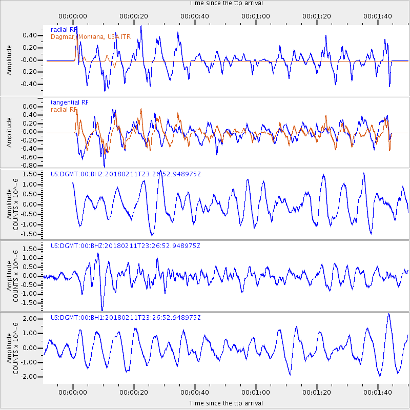
DGMT Dagmar, Montana, USA - Earthquake Result Viewer
*The percent match for this event was below the threshold and hence no stack was calculated.
| Earthquake location: |
South Of Mariana Islands |
| Earthquake latitude/longitude: |
13.8/146.5 |
| Earthquake time(UTC): |
2018/02/11 (042) 23:14:18 GMT |
| Earthquake Depth: |
42 km |
| Earthquake Magnitude: |
6.2 Mi |
| Earthquake Catalog/Contributor: |
NEIC PDE/pt |
|
| Network: |
US United States National Seismic Network |
| Station: |
DGMT Dagmar, Montana, USA |
| Lat/Lon: |
48.47 N/104.20 W |
| Elevation: |
0.0 m |
|
| Distance: |
92.1 deg |
| Az: |
38.945 deg |
| Baz: |
293.443 deg |
| Ray Param: |
$rayparam |
*The percent match for this event was below the threshold and hence was not used in the summary stack. |
|
| Radial Match: |
50.5011 % |
| Radial Bump: |
400 |
| Transverse Match: |
65.851265 % |
| Transverse Bump: |
400 |
| SOD ConfigId: |
2973751 |
| Insert Time: |
2018-10-09 08:06:09.796 +0000 |
| GWidth: |
2.5 |
| Max Bumps: |
400 |
| Tol: |
0.001 |
|
Signal To Noise
| Channel | StoN | STA | LTA |
| US:DGMT:00:BHZ:20180211T23:26:52.948975Z | 2.6719112 | 3.8077906E-7 | 1.4251187E-7 |
| US:DGMT:00:BH1:20180211T23:26:52.948975Z | 1.2334342 | 8.0447177E-7 | 6.5222105E-7 |
| US:DGMT:00:BH2:20180211T23:26:52.948975Z | 1.7237196 | 9.0341956E-7 | 5.2411053E-7 |
| Arrivals |
| Ps | |
| PpPs | |
| PsPs/PpSs | |


