You are here: Home > Network List > UU - University of Utah Regional Network Stations List
> Station KNB Kanab, UT, USA > Earthquake Result Viewer
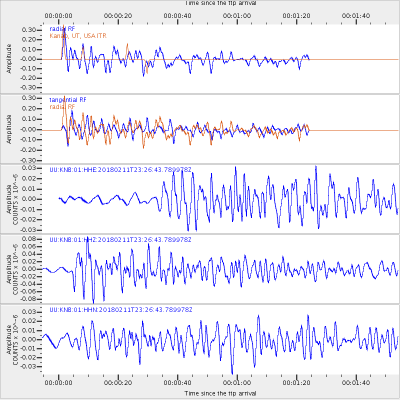
KNB Kanab, UT, USA - Earthquake Result Viewer
*The percent match for this event was below the threshold and hence no stack was calculated.
| Earthquake location: |
South Of Mariana Islands |
| Earthquake latitude/longitude: |
13.8/146.5 |
| Earthquake time(UTC): |
2018/02/11 (042) 23:14:18 GMT |
| Earthquake Depth: |
42 km |
| Earthquake Magnitude: |
6.2 Mi |
| Earthquake Catalog/Contributor: |
NEIC PDE/pt |
|
| Network: |
UU University of Utah Regional Network |
| Station: |
KNB Kanab, UT, USA |
| Lat/Lon: |
37.02 N/112.82 W |
| Elevation: |
1715 m |
|
| Distance: |
90.1 deg |
| Az: |
51.868 deg |
| Baz: |
287.33 deg |
| Ray Param: |
$rayparam |
*The percent match for this event was below the threshold and hence was not used in the summary stack. |
|
| Radial Match: |
84.55213 % |
| Radial Bump: |
400 |
| Transverse Match: |
79.33206 % |
| Transverse Bump: |
332 |
| SOD ConfigId: |
2973751 |
| Insert Time: |
2018-10-09 08:06:29.646 +0000 |
| GWidth: |
2.5 |
| Max Bumps: |
400 |
| Tol: |
0.001 |
|
Signal To Noise
| Channel | StoN | STA | LTA |
| UU:KNB:01:HHZ:20180211T23:26:43.789978Z | 1.0821695 | 5.431626E-9 | 5.0192006E-9 |
| UU:KNB:01:HHN:20180211T23:26:43.789978Z | 2.2344944 | 5.299921E-9 | 2.3718658E-9 |
| UU:KNB:01:HHE:20180211T23:26:43.789978Z | 0.8771934 | 2.1597433E-9 | 2.462106E-9 |
| Arrivals |
| Ps | |
| PpPs | |
| PsPs/PpSs | |


