You are here: Home > Network List > TA - USArray Transportable Network (new EarthScope stations) Stations List
> Station M31A Lambtecht Ranch, Loup City, NE, USA > Earthquake Result Viewer
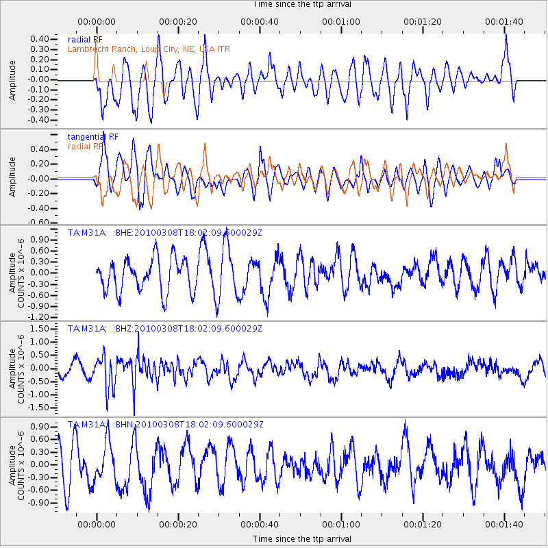
M31A Lambtecht Ranch, Loup City, NE, USA - Earthquake Result Viewer
*The percent match for this event was below the threshold and hence no stack was calculated.
| Earthquake location: |
Near Coast Of Central Chile |
| Earthquake latitude/longitude: |
-32.6/-71.6 |
| Earthquake time(UTC): |
2010/03/08 (067) 17:50:45 GMT |
| Earthquake Depth: |
24 km |
| Earthquake Magnitude: |
5.6 MS, 5.4 MB |
| Earthquake Catalog/Contributor: |
WHDF/NEIC |
|
| Network: |
TA USArray Transportable Network (new EarthScope stations) |
| Station: |
M31A Lambtecht Ranch, Loup City, NE, USA |
| Lat/Lon: |
41.34 N/98.98 W |
| Elevation: |
699 m |
|
| Distance: |
77.8 deg |
| Az: |
339.281 deg |
| Baz: |
156.633 deg |
| Ray Param: |
$rayparam |
*The percent match for this event was below the threshold and hence was not used in the summary stack. |
|
| Radial Match: |
55.174202 % |
| Radial Bump: |
400 |
| Transverse Match: |
55.074947 % |
| Transverse Bump: |
400 |
| SOD ConfigId: |
299721 |
| Insert Time: |
2010-04-26 20:40:54.978 +0000 |
| GWidth: |
2.5 |
| Max Bumps: |
400 |
| Tol: |
0.001 |
|
Signal To Noise
| Channel | StoN | STA | LTA |
| TA:M31A: :BHZ:20100308T18:02:09.600029Z | 2.9871442 | 6.344612E-7 | 2.1239723E-7 |
| TA:M31A: :BHN:20100308T18:02:09.600029Z | 0.90699565 | 4.6445837E-7 | 5.1208445E-7 |
| TA:M31A: :BHE:20100308T18:02:09.600029Z | 1.6920183 | 7.438834E-7 | 4.3964263E-7 |
| Arrivals |
| Ps | |
| PpPs | |
| PsPs/PpSs | |


