You are here: Home > Network List > TA - USArray Transportable Network (new EarthScope stations) Stations List
> Station 434A Burnet, TX, USA > Earthquake Result Viewer
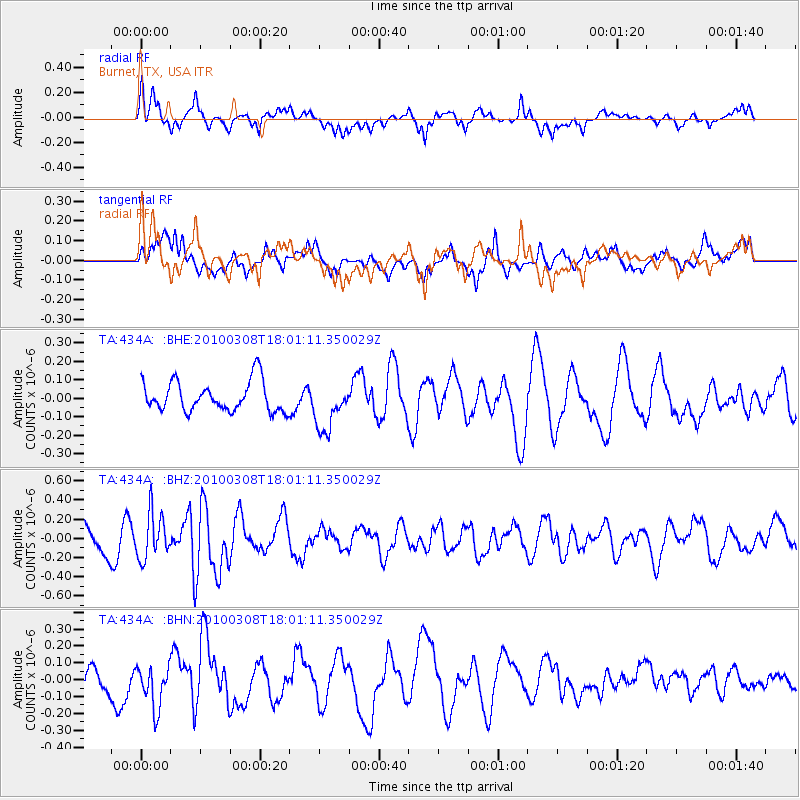
434A Burnet, TX, USA - Earthquake Result Viewer
*The percent match for this event was below the threshold and hence no stack was calculated.
| Earthquake location: |
Near Coast Of Central Chile |
| Earthquake latitude/longitude: |
-32.6/-71.6 |
| Earthquake time(UTC): |
2010/03/08 (067) 17:50:45 GMT |
| Earthquake Depth: |
24 km |
| Earthquake Magnitude: |
5.6 MS, 5.4 MB |
| Earthquake Catalog/Contributor: |
WHDF/NEIC |
|
| Network: |
TA USArray Transportable Network (new EarthScope stations) |
| Station: |
434A Burnet, TX, USA |
| Lat/Lon: |
30.81 N/98.27 W |
| Elevation: |
462 m |
|
| Distance: |
67.9 deg |
| Az: |
335.41 deg |
| Baz: |
155.903 deg |
| Ray Param: |
$rayparam |
*The percent match for this event was below the threshold and hence was not used in the summary stack. |
|
| Radial Match: |
70.578766 % |
| Radial Bump: |
400 |
| Transverse Match: |
51.31632 % |
| Transverse Bump: |
400 |
| SOD ConfigId: |
299721 |
| Insert Time: |
2010-04-26 20:42:10.945 +0000 |
| GWidth: |
2.5 |
| Max Bumps: |
400 |
| Tol: |
0.001 |
|
Signal To Noise
| Channel | StoN | STA | LTA |
| TA:434A: :BHZ:20100308T18:01:11.350029Z | 1.3431048 | 2.3667421E-7 | 1.7621426E-7 |
| TA:434A: :BHN:20100308T18:01:11.350029Z | 1.7752728 | 1.2932882E-7 | 7.2850106E-8 |
| TA:434A: :BHE:20100308T18:01:11.350029Z | 1.6148242 | 1.3093077E-7 | 8.108051E-8 |
| Arrivals |
| Ps | |
| PpPs | |
| PsPs/PpSs | |


