You are here: Home > Network List > US - United States National Seismic Network Stations List
> Station MNTX Cornudas Mountains, Texas, USA > Earthquake Result Viewer
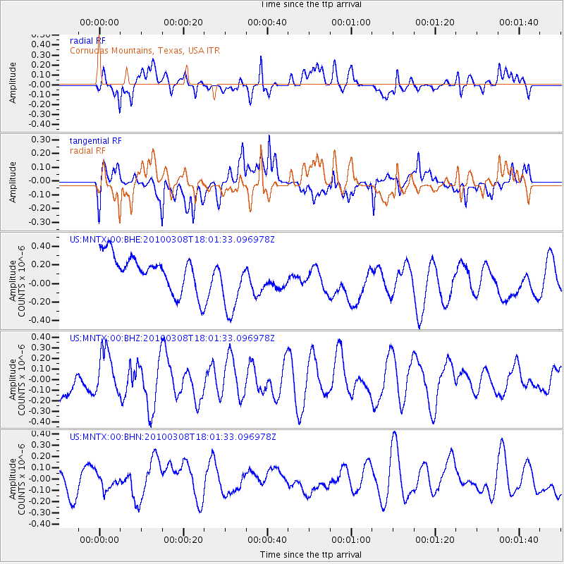
MNTX Cornudas Mountains, Texas, USA - Earthquake Result Viewer
*The percent match for this event was below the threshold and hence no stack was calculated.
| Earthquake location: |
Near Coast Of Central Chile |
| Earthquake latitude/longitude: |
-32.6/-71.6 |
| Earthquake time(UTC): |
2010/03/08 (067) 17:50:45 GMT |
| Earthquake Depth: |
24 km |
| Earthquake Magnitude: |
5.6 MS, 5.4 MB |
| Earthquake Catalog/Contributor: |
WHDF/NEIC |
|
| Network: |
US United States National Seismic Network |
| Station: |
MNTX Cornudas Mountains, Texas, USA |
| Lat/Lon: |
31.70 N/105.38 W |
| Elevation: |
404 m |
|
| Distance: |
71.5 deg |
| Az: |
330.041 deg |
| Baz: |
150.361 deg |
| Ray Param: |
$rayparam |
*The percent match for this event was below the threshold and hence was not used in the summary stack. |
|
| Radial Match: |
51.168438 % |
| Radial Bump: |
400 |
| Transverse Match: |
50.539494 % |
| Transverse Bump: |
400 |
| SOD ConfigId: |
299721 |
| Insert Time: |
2010-04-26 20:44:11.076 +0000 |
| GWidth: |
2.5 |
| Max Bumps: |
400 |
| Tol: |
0.001 |
|
Signal To Noise
| Channel | StoN | STA | LTA |
| US:MNTX:00:BHZ:20100308T18:01:33.096978Z | 1.4127153 | 2.1917961E-7 | 1.5514776E-7 |
| US:MNTX:00:BHN:20100308T18:01:33.096978Z | 0.4945351 | 7.680093E-8 | 1.5529925E-7 |
| US:MNTX:00:BHE:20100308T18:01:33.096978Z | 1.7869221 | 3.3937204E-7 | 1.8991989E-7 |
| Arrivals |
| Ps | |
| PpPs | |
| PsPs/PpSs | |


