You are here: Home > Network List > IC - New China Digital Seismograph Network Stations List
> Station KMI Kunming, Yunnan Province, China > Earthquake Result Viewer
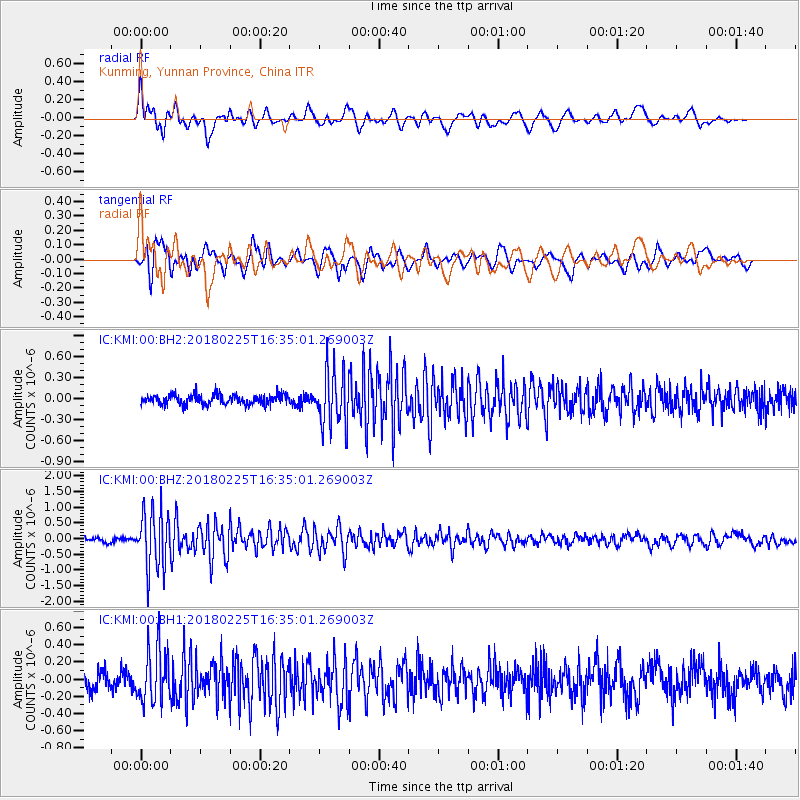
KMI Kunming, Yunnan Province, China - Earthquake Result Viewer
*The percent match for this event was below the threshold and hence no stack was calculated.
| Earthquake location: |
Near East Coast Of Honshu, Japan |
| Earthquake latitude/longitude: |
37.6/141.7 |
| Earthquake time(UTC): |
2018/02/25 (056) 16:28:39 GMT |
| Earthquake Depth: |
31 km |
| Earthquake Magnitude: |
5.6 Mww |
| Earthquake Catalog/Contributor: |
NEIC PDE/us |
|
| Network: |
IC New China Digital Seismograph Network |
| Station: |
KMI Kunming, Yunnan Province, China |
| Lat/Lon: |
25.12 N/102.74 E |
| Elevation: |
1975 m |
|
| Distance: |
35.3 deg |
| Az: |
260.792 deg |
| Baz: |
59.885 deg |
| Ray Param: |
$rayparam |
*The percent match for this event was below the threshold and hence was not used in the summary stack. |
|
| Radial Match: |
78.1244 % |
| Radial Bump: |
400 |
| Transverse Match: |
75.110054 % |
| Transverse Bump: |
400 |
| SOD ConfigId: |
2973751 |
| Insert Time: |
2018-10-09 08:30:10.192 +0000 |
| GWidth: |
2.5 |
| Max Bumps: |
400 |
| Tol: |
0.001 |
|
Signal To Noise
| Channel | StoN | STA | LTA |
| IC:KMI:00:BHZ:20180225T16:35:01.269003Z | 10.679971 | 9.3497124E-7 | 8.7544365E-8 |
| IC:KMI:00:BH1:20180225T16:35:01.269003Z | 3.4013689 | 3.190845E-7 | 9.381062E-8 |
| IC:KMI:00:BH2:20180225T16:35:01.269003Z | 5.5435734 | 3.9451416E-7 | 7.116604E-8 |
| Arrivals |
| Ps | |
| PpPs | |
| PsPs/PpSs | |


