You are here: Home > Network List > AZ - ANZA Regional Network Stations List
> Station SMER AZ.SMER > Earthquake Result Viewer
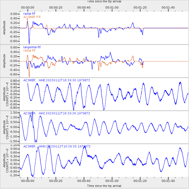
SMER AZ.SMER - Earthquake Result Viewer
*The percent match for this event was below the threshold and hence no stack was calculated.
| Earthquake location: |
South Of Fiji Islands |
| Earthquake latitude/longitude: |
-21.9/179.8 |
| Earthquake time(UTC): |
2023/01/12 (012) 16:28:51 GMT |
| Earthquake Depth: |
596 km |
| Earthquake Magnitude: |
5.5 Mww |
| Earthquake Catalog/Contributor: |
NEIC PDE/us |
|
| Network: |
AZ ANZA Regional Network |
| Station: |
SMER AZ.SMER |
| Lat/Lon: |
33.46 N/117.17 W |
| Elevation: |
355 m |
|
| Distance: |
81.5 deg |
| Az: |
48.91 deg |
| Baz: |
236.847 deg |
| Ray Param: |
$rayparam |
*The percent match for this event was below the threshold and hence was not used in the summary stack. |
|
| Radial Match: |
74.23892 % |
| Radial Bump: |
400 |
| Transverse Match: |
45.55719 % |
| Transverse Bump: |
400 |
| SOD ConfigId: |
29823551 |
| Insert Time: |
2023-01-26 16:33:49.977 +0000 |
| GWidth: |
2.5 |
| Max Bumps: |
400 |
| Tol: |
0.001 |
|
Signal To Noise
| Channel | StoN | STA | LTA |
| AZ:SMER: :HHZ:20230112T16:39:36.197987Z | 1.6490415 | 9.10137E-7 | 5.519188E-7 |
| AZ:SMER: :HHN:20230112T16:39:36.197987Z | 1.648663 | 1.0288355E-6 | 6.2404234E-7 |
| AZ:SMER: :HHE:20230112T16:39:36.197987Z | 1.6184707 | 5.5783175E-7 | 3.4466598E-7 |
| Arrivals |
| Ps | |
| PpPs | |
| PsPs/PpSs | |


