You are here: Home > Network List > IC - New China Digital Seismograph Network Stations List
> Station KMI Kunming, Yunnan Province, China > Earthquake Result Viewer
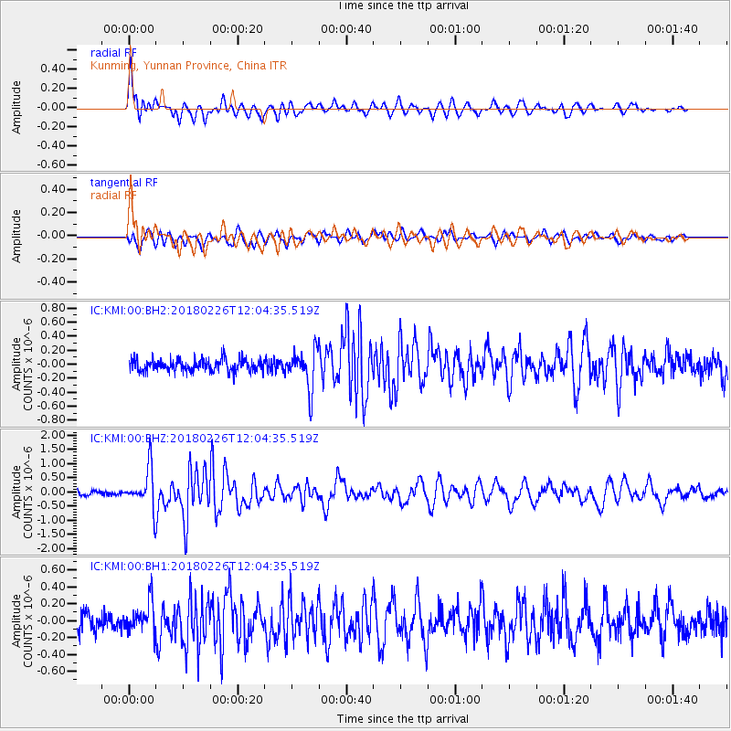
KMI Kunming, Yunnan Province, China - Earthquake Result Viewer
*The percent match for this event was below the threshold and hence no stack was calculated.
| Earthquake location: |
New Guinea, Papua New Guinea |
| Earthquake latitude/longitude: |
-6.5/143.6 |
| Earthquake time(UTC): |
2018/02/26 (057) 11:56:07 GMT |
| Earthquake Depth: |
13 km |
| Earthquake Magnitude: |
5.7 Mww |
| Earthquake Catalog/Contributor: |
NEIC PDE/us |
|
| Network: |
IC New China Digital Seismograph Network |
| Station: |
KMI Kunming, Yunnan Province, China |
| Lat/Lon: |
25.12 N/102.74 E |
| Elevation: |
1975 m |
|
| Distance: |
50.6 deg |
| Az: |
309.975 deg |
| Baz: |
122.858 deg |
| Ray Param: |
$rayparam |
*The percent match for this event was below the threshold and hence was not used in the summary stack. |
|
| Radial Match: |
75.36115 % |
| Radial Bump: |
400 |
| Transverse Match: |
79.583244 % |
| Transverse Bump: |
400 |
| SOD ConfigId: |
2973751 |
| Insert Time: |
2018-10-09 08:41:16.970 +0000 |
| GWidth: |
2.5 |
| Max Bumps: |
400 |
| Tol: |
0.001 |
|
Signal To Noise
| Channel | StoN | STA | LTA |
| IC:KMI:00:BHZ:20180226T12:04:35.519Z | 7.5148892 | 7.1023396E-7 | 9.4510234E-8 |
| IC:KMI:00:BH1:20180226T12:04:35.519Z | 2.0391505 | 1.7794387E-7 | 8.7263736E-8 |
| IC:KMI:00:BH2:20180226T12:04:35.519Z | 3.1214993 | 2.6922433E-7 | 8.62484E-8 |
| Arrivals |
| Ps | |
| PpPs | |
| PsPs/PpSs | |


