You are here: Home > Network List > US - United States National Seismic Network Stations List
> Station RLMT Red Lodge, Montana, USA > Earthquake Result Viewer
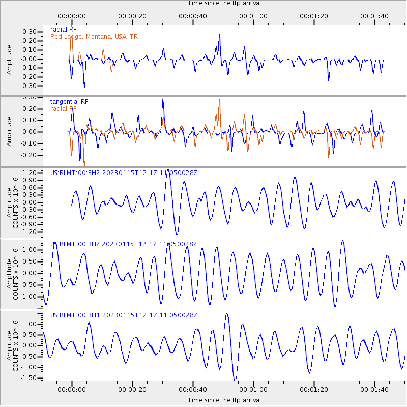
RLMT Red Lodge, Montana, USA - Earthquake Result Viewer
*The percent match for this event was below the threshold and hence no stack was calculated.
| Earthquake location: |
Vanuatu Islands |
| Earthquake latitude/longitude: |
-15.0/166.9 |
| Earthquake time(UTC): |
2023/01/15 (015) 12:04:17 GMT |
| Earthquake Depth: |
29 km |
| Earthquake Magnitude: |
5.6 Mww |
| Earthquake Catalog/Contributor: |
NEIC PDE/us |
|
| Network: |
US United States National Seismic Network |
| Station: |
RLMT Red Lodge, Montana, USA |
| Lat/Lon: |
45.12 N/109.27 W |
| Elevation: |
2086 m |
|
| Distance: |
96.2 deg |
| Az: |
45.073 deg |
| Baz: |
255.153 deg |
| Ray Param: |
$rayparam |
*The percent match for this event was below the threshold and hence was not used in the summary stack. |
|
| Radial Match: |
50.83607 % |
| Radial Bump: |
313 |
| Transverse Match: |
57.3399 % |
| Transverse Bump: |
364 |
| SOD ConfigId: |
29823551 |
| Insert Time: |
2023-01-29 12:19:44.458 +0000 |
| GWidth: |
2.5 |
| Max Bumps: |
400 |
| Tol: |
0.001 |
|
Signal To Noise
| Channel | StoN | STA | LTA |
| US:RLMT:00:BHZ:20230115T12:17:11.050028Z | 0.7135309 | 5.113581E-7 | 7.166587E-7 |
| US:RLMT:00:BH1:20230115T12:17:11.050028Z | 0.69112134 | 2.6883595E-7 | 3.889852E-7 |
| US:RLMT:00:BH2:20230115T12:17:11.050028Z | 3.3144097 | 9.237874E-7 | 2.7871852E-7 |
| Arrivals |
| Ps | |
| PpPs | |
| PsPs/PpSs | |


