You are here: Home > Network List > G - GEOSCOPE Stations List
> Station FOMA Nahampoana reservation, Fort Dauphin, Madagascar > Earthquake Result Viewer
FOMA Nahampoana reservation, Fort Dauphin, Madagascar - Earthquake Result Viewer

| Earthquake location: |
Northern Sumatra, Indonesia |
| Earthquake latitude/longitude: |
2.0/98.0 |
| Earthquake time(UTC): |
2023/01/15 (015) 22:29:58 GMT |
| Earthquake Depth: |
37 km |
| Earthquake Magnitude: |
6.2 Mww |
| Earthquake Catalog/Contributor: |
NEIC PDE/us |
|
| Network: |
G GEOSCOPE |
| Station: |
FOMA Nahampoana reservation, Fort Dauphin, Madagascar |
| Lat/Lon: |
24.98 S/46.98 E |
| Elevation: |
26 m |
|
| Distance: |
56.2 deg |
| Az: |
238.086 deg |
| Baz: |
69.184 deg |
| Ray Param: |
0.06420968 |
| Estimated Moho Depth: |
37.0 km |
| Estimated Crust Vp/Vs: |
1.67 |
| Assumed Crust Vp: |
6.183 km/s |
| Estimated Crust Vs: |
3.697 km/s |
| Estimated Crust Poisson's Ratio: |
0.22 |
|
| Radial Match: |
88.733696 % |
| Radial Bump: |
400 |
| Transverse Match: |
76.84073 % |
| Transverse Bump: |
400 |
| SOD ConfigId: |
29823551 |
| Insert Time: |
2023-01-29 22:35:46.432 +0000 |
| GWidth: |
2.5 |
| Max Bumps: |
400 |
| Tol: |
0.001 |
|
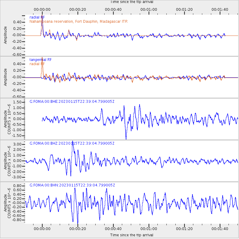
Signal To Noise
| Channel | StoN | STA | LTA |
| G:FOMA:00:BHZ:20230115T22:39:04.799005Z | 3.8875077 | 7.0521213E-7 | 1.8140469E-7 |
| G:FOMA:00:BHN:20230115T22:39:04.799005Z | 1.3628815 | 1.9548028E-7 | 1.434316E-7 |
| G:FOMA:00:BHE:20230115T22:39:04.799005Z | 2.7710283 | 3.6483638E-7 | 1.3166101E-7 |
| Arrivals |
| Ps | 4.2 SECOND |
| PpPs | 15 SECOND |
| PsPs/PpSs | 19 SECOND |


