
MM18 Tyson, Missiouri - Earthquake Result Viewer
| ||||||||||||||||||
| ||||||||||||||||||
| ||||||||||||||||||
|
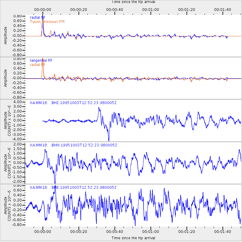
Signal To Noise
| Channel | StoN | STA | LTA |
| XA:MM18: :BHN:19951003T12:52:23.980005Z | 5.136741 | 6.9575395E-7 | 1.3544657E-7 |
| XA:MM18: :BHE:19951003T12:52:23.980005Z | 1.9631267 | 3.1459993E-7 | 1.6025453E-7 |
| XA:MM18: :BHZ:19951003T12:52:23.980005Z | 8.811932 | 1.3069204E-6 | 1.4831258E-7 |
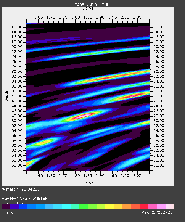
| Arrivals | |
| Ps | 6.6 SECOND |
| PpPs | 20 SECOND |
| PsPs/PpSs | 26 SECOND |

