You are here: Home > Network List > AV - Alaska Volcano Observatory Stations List
> Station AMKA Regional Station, Amchitka Island, Alaska > Earthquake Result Viewer
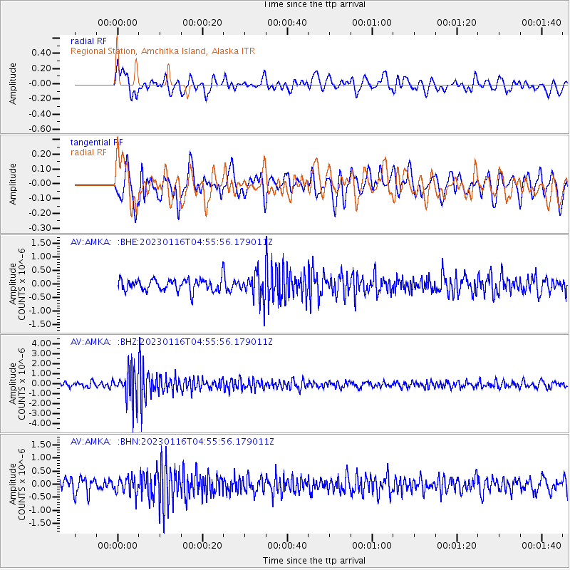
AMKA Regional Station, Amchitka Island, Alaska - Earthquake Result Viewer
*The percent match for this event was below the threshold and hence no stack was calculated.
| Earthquake location: |
Bonin Islands, Japan Region |
| Earthquake latitude/longitude: |
29.0/139.4 |
| Earthquake time(UTC): |
2023/01/16 (016) 04:49:52 GMT |
| Earthquake Depth: |
405 km |
| Earthquake Magnitude: |
6.3 mww |
| Earthquake Catalog/Contributor: |
NEIC PDE/us |
|
| Network: |
AV Alaska Volcano Observatory |
| Station: |
AMKA Regional Station, Amchitka Island, Alaska |
| Lat/Lon: |
51.38 N/179.30 E |
| Elevation: |
116 m |
|
| Distance: |
37.2 deg |
| Az: |
41.736 deg |
| Baz: |
248.525 deg |
| Ray Param: |
$rayparam |
*The percent match for this event was below the threshold and hence was not used in the summary stack. |
|
| Radial Match: |
55.11372 % |
| Radial Bump: |
400 |
| Transverse Match: |
60.427097 % |
| Transverse Bump: |
400 |
| SOD ConfigId: |
29823551 |
| Insert Time: |
2023-01-30 04:57:04.786 +0000 |
| GWidth: |
2.5 |
| Max Bumps: |
400 |
| Tol: |
0.001 |
|
Signal To Noise
| Channel | StoN | STA | LTA |
| AV:AMKA: :BHZ:20230116T04:55:56.179011Z | 6.5112123 | 1.6325474E-6 | 2.5072865E-7 |
| AV:AMKA: :BHN:20230116T04:55:56.179011Z | 1.1211879 | 3.0399502E-7 | 2.7113654E-7 |
| AV:AMKA: :BHE:20230116T04:55:56.179011Z | 2.2584164 | 4.90547E-7 | 2.172084E-7 |
| Arrivals |
| Ps | |
| PpPs | |
| PsPs/PpSs | |


