You are here: Home > Network List > AV - Alaska Volcano Observatory Stations List
> Station PLBL Mt. Peulik Volcano, Alaska > Earthquake Result Viewer
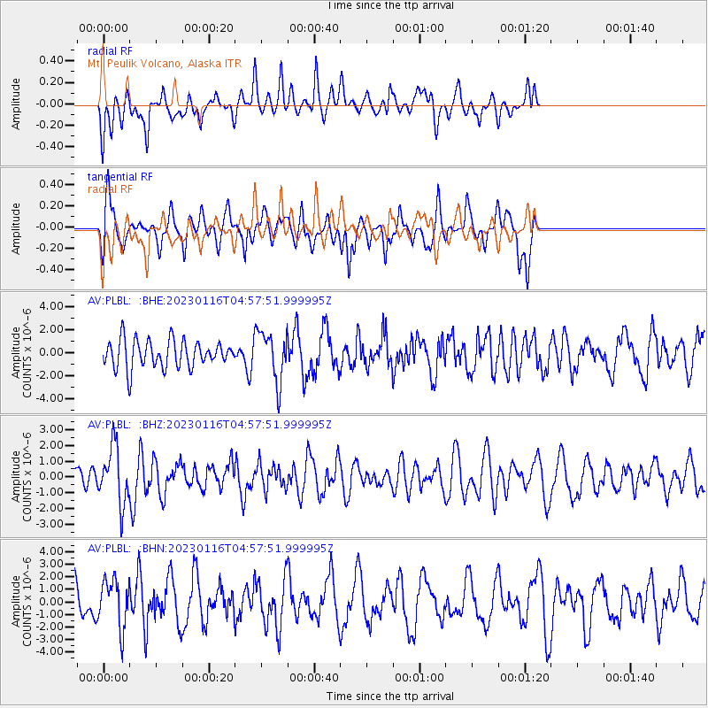
PLBL Mt. Peulik Volcano, Alaska - Earthquake Result Viewer
*The percent match for this event was below the threshold and hence no stack was calculated.
| Earthquake location: |
Bonin Islands, Japan Region |
| Earthquake latitude/longitude: |
29.0/139.4 |
| Earthquake time(UTC): |
2023/01/16 (016) 04:49:52 GMT |
| Earthquake Depth: |
405 km |
| Earthquake Magnitude: |
6.3 mww |
| Earthquake Catalog/Contributor: |
NEIC PDE/us |
|
| Network: |
AV Alaska Volcano Observatory |
| Station: |
PLBL Mt. Peulik Volcano, Alaska |
| Lat/Lon: |
57.70 N/156.82 W |
| Elevation: |
461 m |
|
| Distance: |
52.1 deg |
| Az: |
37.635 deg |
| Baz: |
265.111 deg |
| Ray Param: |
$rayparam |
*The percent match for this event was below the threshold and hence was not used in the summary stack. |
|
| Radial Match: |
47.392124 % |
| Radial Bump: |
262 |
| Transverse Match: |
53.07365 % |
| Transverse Bump: |
331 |
| SOD ConfigId: |
29823551 |
| Insert Time: |
2023-01-30 04:59:07.684 +0000 |
| GWidth: |
2.5 |
| Max Bumps: |
400 |
| Tol: |
0.001 |
|
Signal To Noise
| Channel | StoN | STA | LTA |
| AV:PLBL: :BHZ:20230116T04:57:51.999995Z | 2.709736 | 1.8192738E-6 | 6.7138416E-7 |
| AV:PLBL: :BHN:20230116T04:57:51.999995Z | 1.269882 | 1.9477548E-6 | 1.5338078E-6 |
| AV:PLBL: :BHE:20230116T04:57:51.999995Z | 1.8290685 | 2.1687667E-6 | 1.185722E-6 |
| Arrivals |
| Ps | |
| PpPs | |
| PsPs/PpSs | |


