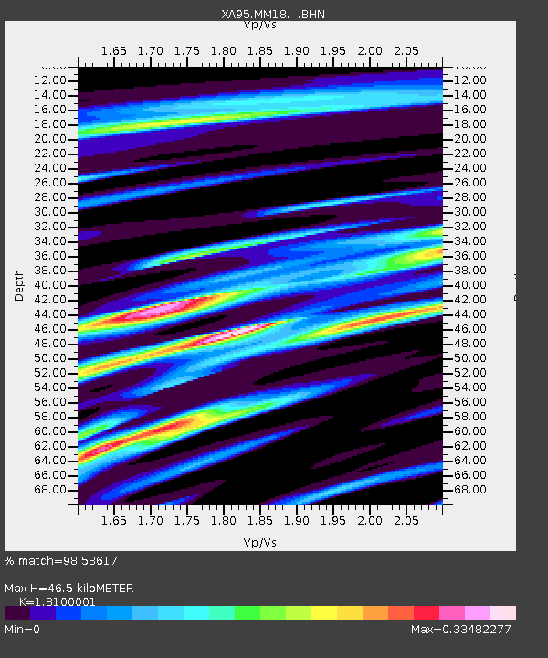
MM18 Tyson, Missiouri - Earthquake Result Viewer
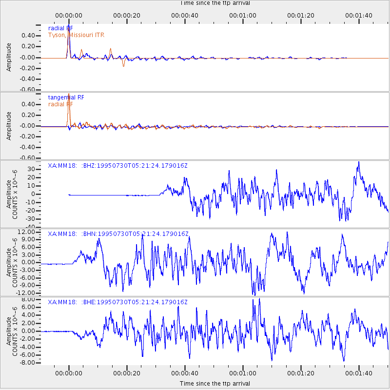
Earthquake location: Near Coast Of Northern Chile
Earthquake latitude/longitude: -23.4/-70.3
Earthquake time(UTC): 1995/07/30 (211) 05:11:23 GMT
Earthquake Depth: 47 km
Earthquake Magnitude: 6.6 MB, 7.3 MS, 7.2 UNKNOWN, 8.1 MW
Earthquake Catalog/Contributor: WHDF/NEIC
Network: XA Missouri to Massachusetts Transect
Station: MM18 Tyson, Missiouri
Lat/Lon: 38.53 N/90.57 W
Elevation: 186 m
Distance: 64.4 deg
Az: 342.48 deg
Baz: 159.347 deg
Ray Param: 0.058830768
Estimated Moho Depth: 46.5 km
Estimated Crust Vp/Vs: 1.81
Assumed Crust Vp: 6.498 km/s
Estimated Crust Vs: 3.59 km/s
Estimated Crust Poisson's Ratio: 0.28
Radial Match: 98.58617 %
Radial Bump: 257
Transverse Match: 89.4318 %
Transverse Bump: 400
SOD ConfigId: 6273
Insert Time: 2010-02-26 17:57:06.147 +0000
GWidth: 2.5
Max Bumps: 400
Tol: 0.001

Signal To Noise

ChannelStoNSTALTA
XA:MM18: :BHN:19950730T05:21:24.179016Z18.2240032.0424138E-61.1207273E-7
XA:MM18: :BHE:19950730T05:21:24.179016Z14.5294758.217917E-75.6560314E-8
XA:MM18: :BHZ:19950730T05:21:24.179016Z29.0769314.7946487E-61.6489528E-7
Arrivals
Ps6.0 SECOND
PpPs19 SECOND
PsPs/PpSs25 SECOND