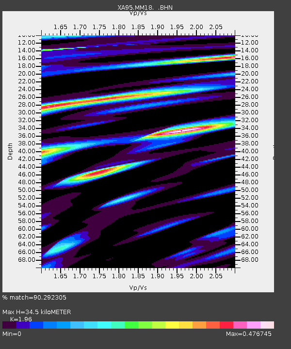
MM18 Tyson, Missiouri - Earthquake Result Viewer
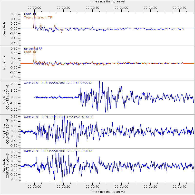
Earthquake location: Unimak Island Region, Alaska
Earthquake latitude/longitude: 53.6/-163.5
Earthquake time(UTC): 1995/07/08 (189) 17:15:28 GMT
Earthquake Depth: 33 km
Earthquake Magnitude: 5.8 MB, 5.7 MS, 5.5 UNKNOWN, 6.0 MW
Earthquake Catalog/Contributor: WHDF/NEIC
Network: XA Missouri to Massachusetts Transect
Station: MM18 Tyson, Missiouri
Lat/Lon: 38.53 N/90.57 W
Elevation: 186 m
Distance: 50.6 deg
Az: 76.155 deg
Baz: 312.523 deg
Ray Param: 0.067902155
Estimated Moho Depth: 34.5 km
Estimated Crust Vp/Vs: 1.96
Assumed Crust Vp: 6.498 km/s
Estimated Crust Vs: 3.315 km/s
Estimated Crust Poisson's Ratio: 0.32
Radial Match: 90.292305 %
Radial Bump: 354
Transverse Match: 76.92427 %
Transverse Bump: 400
SOD ConfigId: 6273
Insert Time: 2010-02-26 17:57:07.563 +0000
GWidth: 2.5
Max Bumps: 400
Tol: 0.001

Signal To Noise

ChannelStoNSTALTA
XA:MM18: :BHN:19950708T17:23:52.92901Z3.9718652.1392573E-75.3860273E-8
XA:MM18: :BHE:19950708T17:23:52.92901Z2.24541972.2358624E-79.9574365E-8
XA:MM18: :BHZ:19950708T17:23:52.92901Z11.1757086.345623E-75.67805E-8
Arrivals
Ps5.4 SECOND
PpPs15 SECOND
PsPs/PpSs20 SECOND