You are here: Home > Network List > TA - USArray Transportable Network (new EarthScope stations) Stations List
> Station P30A Selden, KS, USA > Earthquake Result Viewer
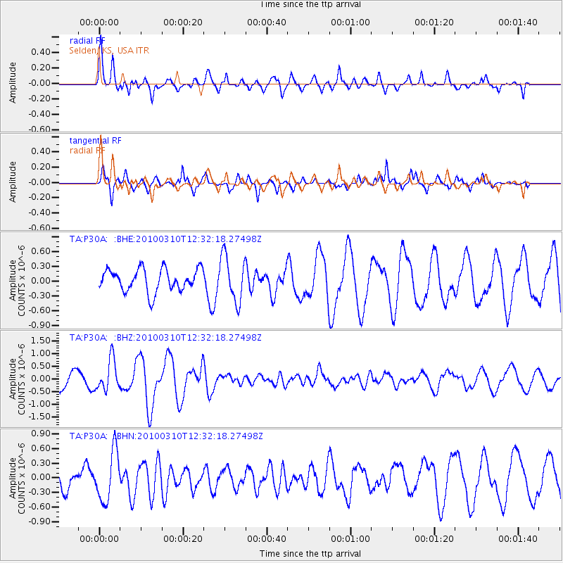
P30A Selden, KS, USA - Earthquake Result Viewer
*The percent match for this event was below the threshold and hence no stack was calculated.
| Earthquake location: |
Off Coast Of Central Chile |
| Earthquake latitude/longitude: |
-33.6/-72.3 |
| Earthquake time(UTC): |
2010/03/10 (069) 12:20:58 GMT |
| Earthquake Depth: |
35 km |
| Earthquake Magnitude: |
5.5 MB, 5.5 MS |
| Earthquake Catalog/Contributor: |
WHDF/NEIC |
|
| Network: |
TA USArray Transportable Network (new EarthScope stations) |
| Station: |
P30A Selden, KS, USA |
| Lat/Lon: |
39.54 N/100.25 W |
| Elevation: |
788 m |
|
| Distance: |
77.2 deg |
| Az: |
338.184 deg |
| Baz: |
156.34 deg |
| Ray Param: |
$rayparam |
*The percent match for this event was below the threshold and hence was not used in the summary stack. |
|
| Radial Match: |
78.42806 % |
| Radial Bump: |
367 |
| Transverse Match: |
70.241394 % |
| Transverse Bump: |
268 |
| SOD ConfigId: |
299721 |
| Insert Time: |
2010-04-26 21:31:11.777 +0000 |
| GWidth: |
2.5 |
| Max Bumps: |
400 |
| Tol: |
0.001 |
|
Signal To Noise
| Channel | StoN | STA | LTA |
| TA:P30A: :BHZ:20100310T12:32:18.27498Z | 2.3711867 | 6.162012E-7 | 2.5987035E-7 |
| TA:P30A: :BHN:20100310T12:32:18.27498Z | 2.4090466 | 5.2218667E-7 | 2.1676072E-7 |
| TA:P30A: :BHE:20100310T12:32:18.27498Z | 2.083365 | 4.7356846E-7 | 2.2730941E-7 |
| Arrivals |
| Ps | |
| PpPs | |
| PsPs/PpSs | |


